place

Inkersall

Chesterfield, DerbyshireHamlets in Derbyshire
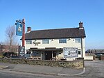
Shops Attlee Road Inkersall Derbyshire

Inkersall and Inkersall Green (informally referred to by local residents as Inky) are areas of settlement in Derbyshire, England. They are located south of the A619 road, 4 miles (6 km) east of Chesterfield and close to Junction 29a of the M1 Motorway. Inkersall is a town just outside Staveley, which has seen fast development over the last few years. Recent developments include the creation of a small children's park along with the building of an additional convenience shop. Inkersall has two public houses, the Hop Flower and the Double Top. The village is served by a regular bus service, allowing residents to travel to Staveley, Chesterfield and elsewhere. The Trans Pennine Trail passes alongside the village.

Excerpt from the Wikipedia article Inkersall (License: CC BY-SA 3.0, Authors, Images).

Inkersall
Dade Avenue,

Geographical coordinates (GPS) Address Nearby Places
placeShow on map

Wikipedia: InkersallContinue reading on Wikipedia

Geographical coordinates (GPS)

Latitude Longitude
N 53.251 ° E -1.373 °
placeShow on map

Address

Dade Avenue

Dade Avenue
S43 3SQ , Hollingwood
England, United Kingdom
mapOpen on Google Maps

Shops Attlee Road Inkersall Derbyshire
Share experience

Nearby Places

Calow
Calow

Calow is a village and civil parish in the county of Derbyshire in England. The population of the village at the 2011 census was 2,494. Calow is in the North East Derbyshire local government district of Derbyshire and is located immediately adjacent to the larger market town of Chesterfield. The origins of the village date back to 1086, when it was known as Kalehal (the bare corner of land). In 1430 it was known as Calell, then Calo in 1561 before acquiring its present name. It is recorded that there was a manor house which ’belonged to the king’ around the same time that the Domesday Book was compiled. The manor was in the possession of the successive families of Breton, Loudham and Foljambe, which were notable families at the time. Coal and iron were worked in the village and for some time blast furnaces were in operation. Coal mined in Calow supplied furnaces in the nearby village of Duckmanton. Calow is now considered a suburb of Chesterfield, although it is not in the town's borough. The Chesterfield Royal Hospital, built just outside the boundaries of Calow, was opened in 1984. Amenities in Calow include; shops, a small park, a chemist, a primary school and a community centre. Methodist minister the Rev'd Kathleen Richardson took as her title ’Baroness Richardson of Calow’, after the village, when she was created a life peer in 1998. Baroness Richardson was the subject of an edition BBC Radio 4 programme Lords A Living. The programme, broadcast in January 2011, reflected on the Baroness returning to visit the village in which she spent her childhood.The village Scout Group was formed by the Reverend C. W. Handford in 1933. The group celebrated its 75th anniversary in 2008 with a number of events, some of which were attended by Mr Clifford Parker, a survivor from the original 1933 group. The group has established international links with groups in Canada and Australia. The Pipe-field (known as the 'Pipey' to locals) is a notable location in Calow. Named as such due to a pipe which runs under the field and is exposed towards one end.