place

Duckmanton Tunnel

Lancashire, Derbyshire and East Coast Railway structuresRail transport in DerbyshireRailway tunnels in EnglandTunnels in DerbyshireUse British English from February 2018
Duckmanton Tunnel (geograph 2315300)

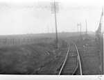
Duckmanton Tunnel is a former 501-yard (458-metre) long twin-track railway tunnel between Chesterfield and Arkwright Town in Derbyshire, England.

Excerpt from the Wikipedia article Duckmanton Tunnel (License: CC BY-SA 3.0, Authors, Images).

Duckmanton Tunnel
Deepsick Lane, North East Derbyshire Sutton cum Duckmanton CP

Geographical coordinates (GPS) Address Nearby Places
placeShow on map

Wikipedia: Duckmanton TunnelContinue reading on Wikipedia

Geographical coordinates (GPS)

Latitude Longitude
N 53.228944444444 ° E -1.3670277777778 °
placeShow on map

Address

Deepsick Lane

Deepsick Lane
S44 5DN North East Derbyshire, Sutton cum Duckmanton CP
England, United Kingdom
mapOpen on Google Maps

Duckmanton Tunnel (geograph 2315300)
Share experience

Nearby Places

Calow
Calow

Calow is a village and civil parish in the county of Derbyshire in England. The population of the village at the 2011 census was 2,494. Calow is in the North East Derbyshire local government district of Derbyshire and is located immediately adjacent to the larger market town of Chesterfield. The origins of the village date back to 1086, when it was known as Kalehal (the bare corner of land). In 1430 it was known as Calell, then Calo in 1561 before acquiring its present name. It is recorded that there was a manor house which ’belonged to the king’ around the same time that the Domesday Book was compiled. The manor was in the possession of the successive families of Breton, Loudham and Foljambe, which were notable families at the time. Coal and iron were worked in the village and for some time blast furnaces were in operation. Coal mined in Calow supplied furnaces in the nearby village of Duckmanton. Calow is now considered a suburb of Chesterfield, although it is not in the town's borough. The Chesterfield Royal Hospital, built just outside the boundaries of Calow, was opened in 1984. Amenities in Calow include; shops, a small park, a chemist, a primary school and a community centre. Methodist minister the Rev'd Kathleen Richardson took as her title ’Baroness Richardson of Calow’, after the village, when she was created a life peer in 1998. Baroness Richardson was the subject of an edition BBC Radio 4 programme Lords A Living. The programme, broadcast in January 2011, reflected on the Baroness returning to visit the village in which she spent her childhood.The village Scout Group was formed by the Reverend C. W. Handford in 1933. The group celebrated its 75th anniversary in 2008 with a number of events, some of which were attended by Mr Clifford Parker, a survivor from the original 1933 group. The group has established international links with groups in Canada and Australia. The Pipe-field (known as the 'Pipey' to locals) is a notable location in Calow. Named as such due to a pipe which runs under the field and is exposed towards one end.

Temple Normanton
Temple Normanton

Temple Normanton is a village and a civil parish in Derbyshire, England. The population of the civil parish at the 2011 census was 490. It is in the North East Derbyshire district of the county. The village sits on a prominent hilltop three miles (5 km) south of Chesterfield. It is composed of two villages formerly known as North Normanton and Little Normanton. It is close to the villages of Heath, Holmewood, Grassmoor and the civil parish of Sutton cum Duckmanton. The Chesterfield suburb of Hasland is close by. The Manor of Normanton at the time of the Domesday Survey was in the hands of the King. Later, it passed to the Order of the Knights Templar from whom it derived its prefix 'Temple'. When the Knights Templar were dissolved in the early 14th century, the land and property of the village passed to the Order of the Hospital of St. John at Yeaveley Preceptory. Later, Henry VIII charged the Order of St. John with disloyalty, and it was dissolved. The village then passed to the hands of the crown. In 1846, Robert Arkwright was Lord of the Manor and principal owner. At the time the village had 500 acres (2.0 km2) of land, 29 houses and 132 inhabitants. In the Borough Library at Derby is held a parchment roll comprising 70 sheets stitched together. This records the proceedings of the Manor Court of Temple Normanton from 1447 to 1518. John Babbington is mentioned as a Knight of St. John, and many of the roads listed in the roll are still traceable on present day Ordnance Survey maps. Early in the industrial age the area became known for coal mining, with numerous collieries located in the vicinity. These included the massive Bonds Main Colliery which lasted from 1896 to 1949. The Chesterfield loop of the Great Central Railway also ran through the area, opened in June 1892. A Bonds Main Platform was provided for mine workers, but the nearest public station was located at Grassmoor and this closed in October 1940, the line itself closing to passenger traffic in March 1963. Sections remained for a while serving the various collieries but as these closed so the line disappeared completely. Modern Temple Normanton includes a primary school, a church, a cemetery and an MOT garage, but no shops. There are also regular buses to Chesterfield, Alfreton, Mansfield and Nottingham.