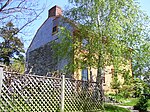
Miantonomi Memorial Park

Miantonomi Memorial Park is a public park between Hillside Avenue and Girard Avenue in Newport, Rhode Island. The Narragansett Indians used the area around the park for hundreds of years and the park (and the hill it is on) is named after Sachem, or Chief, Miantonomi. This hill was Miantonomi's seat of power until it was purchased by English colonists in 1637. The settlers used the hill as a lookout and in 1667 built a beacon on the hill. During the American Revolutionary War fortifications were built on the hill, fragments of which still survive. In 1921, the City of Newport received the property from the local Stokes family. Miantonomi Memorial Park's 30 acres (120,000 m2) became part of the Aquidneck Land Trust through an easement in 2005.[1]
Excerpt from the Wikipedia article Miantonomi Memorial Park (License: CC BY-SA 3.0, Authors, Images).Miantonomi Memorial Park
Hillside Avenue, Newport
Geographical coordinates (GPS) Address Nearby Places Show on map
Geographical coordinates (GPS)
| Latitude | Longitude |
|---|---|
| N 41.5108 ° | E -71.3102 ° |
Address
Miantonomi Memorial Park Tower
Hillside Avenue
02841 Newport
Rhode Island, United States
Open on Google Maps


