place

Wye Head

Derbyshire geography stubsGeography of DerbyshireHigh Peak, Derbyshire
Wye Head
Wye Head

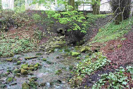
Wye Head is an area in Derbyshire, England. It is in the civil parish of Burbage, on the outskirts of Buxton. It is so named because of a major rising of the River Wye, which carries much of the water from Poole's Cavern.

Excerpt from the Wikipedia article Wye Head (License: CC BY-SA 3.0, Authors, Images).

Wye Head
Wye Head Close, High Peak

Geographical coordinates (GPS) Address Nearby Places
placeShow on map

Wikipedia: Wye HeadContinue reading on Wikipedia

Geographical coordinates (GPS)

Latitude Longitude
N 53.255 ° E -1.928 °
placeShow on map

Address

Wye Head Close

Wye Head Close
SK17 9AX High Peak
England, United Kingdom
mapOpen on Google Maps

Wye Head
Wye Head
Share experience

Nearby Places

Burbage, Derbyshire
Burbage, Derbyshire

Burbage is a village in Derbyshire and was a parish until 1961, when it became part of the parish of Buxton. At the 2011 Census Burbage was a ward of the High Peak Borough Council. The population taken at this Census was 2,540.Burbage is well known for its brass band, the Burbage Band (Buxton). Burbage backs onto Grinlow Woods to the south and provides access to Solomon's Temple. Burbage Edge overlooks the settlement from the west.Burbage Tunnel (now blocked) is a remnant of the Cromford and High Peak Railway, which operated from 1831 to 1967, although the section near Burbage was abandoned in the 1890s in favour of a new alignment via Buxton. Christchurch at Burbage was designed by Henry Currey (architect for the Duke of Devonshire's estate) and was built in 1861. The Public Hall at Burbage was opened in July 1894 by Lady Cavendish and Lady Goring. It was built opposite Christchurch at the junction of Leek Road and Old Macclesfield Road. The hall held 400 people and was used for all the public events in Burbage for decades. The Burbage war memorial was erected beside it. Later it became Worth’s garage and car showroom. At the eastern end of the building were four shops, occupied amongst others by Thomas’s Grocers, Bonsall’s butchers and Edward’s newsagents. The building was demolished in 2007.Burbage Golf Club (now defunct) first appeared in 1899. It continued until the 1920s.The Duke pub (formerly the Duke of York Inn) on St John's Road is a free house. The Red Lion on Holmfield was built in 1842 but it is no longer a pub.Photographs of Burbage can be found at GENUKI.

Cavendish Golf Club
Cavendish Golf Club

Cavendish Golf Club in Buxton, Derbyshire, opened in 1925 and was designed by Alister MacKenzie. The course is 5,721 yards (5,231 m) long with a par of 68. It is consistently voted as one of the top 100 golf courses in England. In 1923, Victor Cavendish, 9th Duke of Devonshire, commissioned Dr Alister MacKenzie to create and build an 18-hole golf course on moorland owned by the Devonshire estate in Buxton. The course was open to men and women from its opening in 1925. The Cavendish was one of MacKenzie's last UK course designs. He went on to design courses in Australasia, South America and the USA, including the world-famous Augusta National golf course, which opened in 1932 and hosts The Masters annual major golf championship. The Cavendish course was bought by the members from the 11th Duke of Devonshire in 1955. Although the course is under 6,000 yards long, the design of the sloping greens is acknowledged as its main challenge. The course record of 61 is 7 under par.In the 1990s, many native deciduous trees were planted around the course, funded by grants from the Forestry Commission.Buxton and High Peak Golf Club was the first golf course in Buxton, founded in 1886 on Fairfield Common. In 1899, the Ladies Golf Club's nine hole course was set out on Temple Meads (which was developed as a housing estate in the 1960s). After the First World War, Canadian troops based in Buxton created a toboggan run across what would later be the first three fairways of the Cavendish course. The toboggan run is still marked on the OS Explorer Map OL24. The Peak District Boundary Walk runs across the golf course.
Corbar Hill
Corbar Hill

Corbar Hill is a sandstone hill at the south end of Combs Moss, overlooking Buxton in Derbyshire, in the Peak District. The summit (marked by a trig pillar) is 437 metres (1,434 ft) above sea level.The north west side of the hill (and most of Combs Moss and Black Edge) is designated as "open access" land for the public, following the Countryside and Rights of Way Act 2000.Corbar Cross was a gift from the Duke of Devonshire to Buxton Catholics, who erected it at the summit in 1950 to mark the Holy Year declared by Pope Pius XII. The cross was painted pink as a prank in the 1990s. Protesters against Pope Benedict XVI's visit to the UK in 2010 cut down the cross. A replacement 6-metre-high (20 ft) solid oak cross was donated by a firm in Lancashire and installed in 2011. Corbar Woods is Buxton's oldest woodland and is included in Buxton's "The Park" conservation area. Its 54 acres are owned and managed by the Buxton Civic Association. The woods were used for coppicing trees in medieval times. There are remains of a white coal pit, which used dried coppice branches to generate the high temperatures needed to smelt lead. The 19th-century paths through the ancient woods, known as the Victorian Swiss Walks, were designed by Joseph Paxton (who also laid out the original Buxton Pavilion Gardens). These paths allowed visitors to the spa town to enjoy views over Buxton's fine buildings from the hilltop. The "Ring of Trees" waymarked walk around Buxton runs through Corbar Wood. The main tree species are beech, yew and oak. The woodland floor at the higher west end of the woods is covered with swathes of bluebells each May. The woods are habitat to common birds (such as thrushes, tits and finches) but are also home to nuthatches and woodpeckers. Corbar Hill House (on Corbar Road in Buxton) is a Grade II listed building. It was built in the 19th century in the style of a French château (with a mansard roof and fountain), apparently for the Ryder family. It later became John Duncan School, which closed in 2003. It has now been converted into private apartments. Corbar Hill Hydro was converted from the Clarendon guest house in the 1890s to offer hydropathic treatments. It was sold in the 1930s for nurses' accommodation.Nithen Quarry on Corbar Hill was used for many years as a source of high quality sandstone for the buildings of Buxton, including the town hall, which was built in the 1890s.