place

Buxton Community School

1993 establishments in EnglandAcademies in DerbyshireBuxtonEast Midlands school stubsEducational institutions established in 1993
Secondary schools in DerbyshireUse British English from February 2023

Buxton Community School is a coeducational secondary school and sixth form located in Buxton, Derbyshire, England. The school was officially opened on 19 October 1993 achieving the consolidation of four former Buxton schools on the site of the previous Buxton College. The school is a specialist sports college. The headteacher is Sam Jones.In 2010 an Engineering Centre was added to the site and was officially opened by The Duke of Devonshire on the 13th October. A 3G artificial all-weather grass pitch was a further addition in 2012 and this opened by Howard Webb MBE. Previously a voluntary controlled school administered by Derbyshire County Council, in June 2023 Buxton Community School converted to academy status. The school is now sponsored by the Embark Federation. Academies have more autonomy with the National Curriculum and receive direct funding from the UK Government.

Excerpt from the Wikipedia article Buxton Community School (License: CC BY-SA 3.0, Authors).

Buxton Community School
College Road, High Peak Fairfield

Geographical coordinates (GPS) Address Phone number Website External links Nearby Places
placeShow on map

Wikipedia: Buxton Community SchoolContinue reading on Wikipedia

Geographical coordinates (GPS)

Latitude Longitude
N 53.2508 ° E -1.9217 °
placeShow on map

Address

Buxton Community School

College Road
SK17 9EA High Peak, Fairfield
England, United Kingdom
mapOpen on Google Maps

Phone number
Embark Multi Academy Trust

call+44129823122

Website
buxton.derbyshire.sch.uk

linkVisit website

linkWikiData (Q5003262)
linkOpenStreetMap (96398069)

Share experience

Nearby Places

Solomon's Temple, Buxton

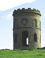
Solomon's Temple, also known as Grinlow Tower, is a Victorian folly on the summit of Grin Low hill, near the spa town of Buxton in the Derbyshire Peak District.On 23 February 1894, a meeting at Buxton Town Hall decided to rebuild a landmark tower that had been built by Solomon Mycock, of the Cheshire Cheese Hotel, in the early 19th century, and of which only a few stones remained. The Local Board vice-chairman had talked with the seventh Duke of Devonshire's agent and decided that the reconstruction was feasible if the townspeople would donate sufficient money. Sketches were submitted by architects W. R. Bryden and G. E. Garlick. By that May, the plans were confirmed by the Duke of Devonshire, and it was well known that the site was of prehistoric importance. In June 1894, the seventh Duke of Devonshire subscribed £25 towards building the folly. Buxton had already subscribed £50. The foundation stone was laid by Colonel Sidebottom, M.P., on 31 May 1896, witnessed by a large crowd, and the tower was opened by Victor Cavendish in September 1896. The tower was restored in 1988 by public subscription.The structure is a 20-foot-high (6.1 m), two-storey tower built on top of a Bronze Age barrow, sitting on top of a ridge at a height of 440 metres (1,440 ft) above sea level. From the open top of the tower there are good 360-degree views over the town and the surrounding countryside and parts of the Peak District. The tower does not contain anything other than the staircase to the top. It is a Grade II listed building.

Burbage, Derbyshire
Burbage, Derbyshire

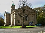
Burbage is a village in Derbyshire and was a parish until 1961, when it became part of the parish of Buxton. At the 2011 Census Burbage was a ward of the High Peak Borough Council. The population taken at this Census was 2,540.Burbage is well known for its brass band, the Burbage Band (Buxton). Burbage backs onto Grinlow Woods to the south and provides access to Solomon's Temple. Burbage Edge overlooks the settlement from the west.Burbage Tunnel (now blocked) is a remnant of the Cromford and High Peak Railway, which operated from 1831 to 1967, although the section near Burbage was abandoned in the 1890s in favour of a new alignment via Buxton. Christchurch at Burbage was designed by Henry Currey (architect for the Duke of Devonshire's estate) and was built in 1861. The Public Hall at Burbage was opened in July 1894 by Lady Cavendish and Lady Goring. It was built opposite Christchurch at the junction of Leek Road and Old Macclesfield Road. The hall held 400 people and was used for all the public events in Burbage for decades. The Burbage war memorial was erected beside it. Later it became Worth’s garage and car showroom. At the eastern end of the building were four shops, occupied amongst others by Thomas’s Grocers, Bonsall’s butchers and Edward’s newsagents. The building was demolished in 2007.Burbage Golf Club (now defunct) first appeared in 1899. It continued until the 1920s.The Duke pub (formerly the Duke of York Inn) on St John's Road is a free house. The Red Lion on Holmfield was built in 1842 but it is no longer a pub.Photographs of Burbage can be found at GENUKI.

The Slopes, Buxton
The Slopes, Buxton

The Slopes (formerly known as The Terrace) is a Grade-II-listed public park in Buxton, Derbyshire in England. The area was laid out by landscape architect Jeffry Wyatville in 1811 for William Cavendish, 6th Duke of Devonshire, as pleasure grounds for the guests of The Crescent hotel to promenade. The design of The Terrace was modified further by Sir Joseph Paxton in 1859.The grassed bank of The Slopes lies between the Town Hall and Higher Buxton at the top and St Ann's Well and the Pump Room (into which the Buxton spring mineral waters were piped) at the bottom, facing The Crescent hotel, the Victorian spa baths and the Old Hall Hotel. The terraced area is intersected with numerous footpaths. The Terrace had previously been a bare hillside known as St Ann's Cliff. In 1787 Major Hayman Rooke uncovered a long section of the Roman town wall, which is now beneath the landscaped hillside of The Slopes. At the same time Rooke also documented details of the base of a temple in the same area, overlooking the site of the baths and springs. The temple was dedicated to the water deity Arnemetia. It had a shrine room set on a rectangular podium, with a columned portico at the front. Twelve Grade-II*-listed 18th-century decorated limestone urns (originally from Lord Burlington's estate at Londesborough Hall in Yorkshire) are set on gritstone plinths along walled footpaths and stone steps.Buxton Town Hall looks down from the top of The Slopes. It was designed by William Pollard in a French Renaissance style and built between 1887 and 1889.The Grade-II-listed war memorial from c.1920 commemorates the soldiers from Buxton who perished in the two World Wars. An ashlar obelisk on a stepped platform is fronted by a bronze statue of Winged Victory holding a sword and a laurel wreath. The sculptor was Louis Frederick Roslyn.The Met Office climatological station for Buxton is situated on The Slopes directly above the war memorial. The instruments at the station record various meteorological measurements (including temperatures, rainfall, humidity and wind speed and direction), which are read daily by volunteers. Buxton's weather was formally recorded in the grounds of Devonshire Royal Hospital since 1865. The climatological station was relocated to its present site in 1925. It is one of the oldest weather stations in the UK.The Slopes were restored in 1994 with grants from the European Commission and English Heritage.