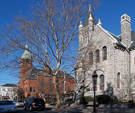
Warren Waterfront Historic District

The Warren Waterfront Historic District encompasses the center of Warren, Rhode Island. It is bounded on the west by the Warren River, on the north roughly by Belcher Cove, on the east roughly by Federal and Main Streets, and on the south by Campbell Street. This area is a densely built residential, commercial, and civic area that has been the center of Warren since the mid-18th century. The town prospered in the 19th century, first as a whaling and shipbuilding center and later with industrial development. The district includes the town's major civic buildings, as well as a wide variety of housing in 19th century revival and Victorian styles. It was listed on the National Register of Historic Places in 1974, and enlarged in 2003.
Excerpt from the Wikipedia article Warren Waterfront Historic District (License: CC BY-SA 3.0, Authors, Images).Warren Waterfront Historic District
Narragansett Way,
Geographical coordinates (GPS) Address Nearby Places Show on map
Geographical coordinates (GPS)
| Latitude | Longitude |
|---|---|
| N 41.730833333333 ° | E -71.284444444444 ° |
Address
Narragansett Way
02885
Rhode Island, United States
Open on Google Maps


