Opdorp
BuggenhoutEast Flanders geography stubsPopulated places in East Flanders

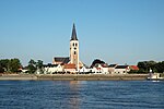
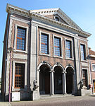
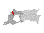
Opdorp is one of the three towns making up the municipality of Buggenhout in East Flanders, Belgium. Sometimes it's classified in the Denderstreek. Opdorp is at the geographical centre of Flanders, Belgium. It is also the point at which three provinces meet: Brabant, Antwerp, and East Flanders.Opdorp developed around a triangular dries (village square). The dries contains a chapel and the village pump. The town hall, school and former monastery were built around the square.
Excerpt from the Wikipedia article Opdorp (License: CC BY-SA 3.0, Authors, Images).Opdorp
Dries,
Geographical coordinates (GPS) Address Nearby Places Show on map
Geographical coordinates (GPS)
| Latitude | Longitude |
|---|---|
| N 51.02744 ° | E 4.2204 ° |
Address
Parochielokaal 't Klokske
Dries 54
9255
East Flanders, Belgium
Open on Google Maps


