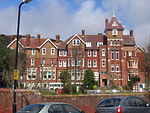
Holywell, Eastbourne
Areas of Eastbourne

Holywell (traditional local pronunciation "holly well") is a part of Meads, a district of Eastbourne in the county of East Sussex, UK. Holywell has no specific boundaries, but lies approximately between the western end of the lower promenade and the chalk pinnacle below Bede's Preparatory School.
Excerpt from the Wikipedia article Holywell, Eastbourne (License: CC BY-SA 3.0, Authors, Images).Holywell, Eastbourne
Holywell drive,
Geographical coordinates (GPS) Address Nearby Places Show on map
Geographical coordinates (GPS)
| Latitude | Longitude |
|---|---|
| N 50.753611111111 ° | E 0.27277777777778 ° |
Address
Holywell Tea Chalet
Holywell drive
BN20 7XB , Holywell
England, United Kingdom
Open on Google Maps


