place

Lake Mills (Washington)

Lakes of Clallam County, WashingtonLandforms of Olympic National ParkProtected areas of Clallam County, WashingtonReservoirs in Washington (state)
Lake Mills, Washington

Lake Mills was a reservoir in Olympic National Park, Washington, United States, that existed from 1927 to 2012. It was formed by the Glines Canyon Dam on the Elwha River and was located about 13 miles from the mouth of the river on the Olympic Peninsula. The lake was formed in 1927 with the completion of the dam and after the lowland forest that occupied the river bottom was clear-cut. With no fish passage facilities, the dam blocked passage of anadromous Pacific Salmon from the upper 50+ miles of the Elwha watershed located within Olympic National Park. The Elwha Ecosystem Restoration project included the removal of the Glines Canyon Dam in 2014. The lake was fully drained by October 2012, leaving only sediment upstream of the former dam site. Olympic National Park crews are revegetating the area to speed up ecological restoration and improve the habitat for the return of the salmon. Lake Mills was a habitat for rainbow trout, bull trout, and Dolly Varden trout which used the lake as their adult habitat because the dam blocked access to the Pacific Ocean. It is expected that, following removal of the dam, these fish will return to their natural anadromous lifestyle.

Excerpt from the Wikipedia article Lake Mills (Washington) (License: CC BY-SA 3.0, Authors, Images).

Lake Mills (Washington)
Smokey Bottom Trail,

Geographical coordinates (GPS) Address Nearby Places
placeShow on map

Wikipedia: Lake Mills (Washington)Continue reading on Wikipedia

Geographical coordinates (GPS)

Latitude Longitude
N 47.988888888889 ° E -123.60555555556 °
placeShow on map

Address

Smokey Bottom Trail

Smokey Bottom Trail

Washington, United States
mapOpen on Google Maps

Lake Mills, Washington
Share experience

Nearby Places

Altair Campground Community Kitchen

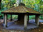
The Altair Campground Community Kitchen, also known as Altaire Campground Community Kitchen, was built in Olympic National Park, Washington, United States, to serve the Altair Campground. It is an open rectangular shelter built in 1935 by the Civilian Conservation Corps personnel from the Elwha River Camp in the National Park Service Rustic style. Located near the Elwha River, the peeled log structure is capped with a cedar shake roof, enclosing a cooking fireplace and chimney. It measures about 28 feet (8.5 m) by 17 feet (5.2 m), with a stone cooking fireplace in the middle, rising through the roof. The lower portions of the log columns have been replaced with concrete piers due to deterioration, and the original peeled log railings have disappeared.The Altair and Elwha Campground Community Kitchens are the only such structures remaining in Olympic National Park. The Altair campground was named after the USS Altair, whose crew regularly used the site in the 1920s and 1930s. The kitchen structure was listed on National Register of Historic Places on July 13, 2007.By 2014 the Elwha Dam and all other dams along the Elwha River were removed. When the river flooded in November 2015, both Altair and Elwha Campgrounds were severely damaged by water. National Park Service has no plans to restore the two campgrounds. As of May 2023, rangers at Olympic National Park confirmed the Altair Kitchen was under about 9 feet of sediment, and the Elwha Kitchen is completely covered in sediment from the Elwha River.

Geyser Valley trail
Geyser Valley trail

The Geyser Valley trail in Olympic National Park is an area along the Elwha River between Rica Canyon and the Grand Canyon of the Elwha, where many homesteaders tried to eke out a living in the late 19th and early 20th centuries. Today, this trail allows hikers to visit several interesting sites, as well as, providing several loops of different lengths. The route begins at Whiskey Bend Trailhead, at the end of Whiskey Bend road, approximately 5 miles from the Elwha Ranger Station. It travels for about 1.3 miles along the Elwha River trail, before the first descent down approximately 400 feet to Goblins Gate at the head of Rica Canyon. The trail continues along the Elwha River through a riparian forest of bigleaf maple, red alder, black cottonwood, with Douglas fir, Western red cedar, and Grand fir. The trail passes the alder grove of Krause Bottom, where the first possible loop back up the slope heads up, and some old homesteader clearings, before arriving at Humes Ranch Cabin, approximately 3 miles from the trailhead. Humes Ranch Cabin is maintained today by the National Park Service as a historic site, and the meadows below the cabin are kept open as Humes once did. You can also see 100-year-old fruit trees in the pastures. Approximately 3/4 of a mile further, the trail climbs the eroding cliffs along the river and crosses Dodger point bridge at the mouth of the Grand Canyon of the Elwha. This marks the end of Geyser Valley, but the trail continues for 11 miles up to the summit of Dodger Point Mountain at over 5,700 ft. It is possible to begin looping back to the Elwha river trail, by slowly climbing the slope. The trail will meet the short-cut coming up from Humes Ranch Cabin and then will pass the old homestead of Michael's Cabin. The trail then heads back on a level grade back towards Whiskey Bend trailhead. Homesteaders historically reported seeing enormous numbers of salmon coming up the river each year to spawn. However, salmon have been blocked from the upper 65 miles of river habitat with the construction of the Elwha Dam in 1913. However, both the Elwha Dam and Glines Canyon Dam were removed in 2012. As part of the Elwha Ecosystem Restoration project, Chinook salmon began returning to the Geyser Valley.