place

Luton and Dunstable University Hospital

DunstableHospital buildings completed in 1882Hospital buildings completed in 1902Hospital buildings completed in 1939Hospitals in Bedfordshire
LutonNHS hospitals in England
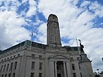
Luton and Dunstable Hospital geograph.org.uk 1838969

Luton and Dunstable University Hospital is an acute hospital in Luton, Bedfordshire, England, run by Bedfordshire Hospitals NHS Foundation Trust. It provides medical and surgical services for over 350,000 people in southern Bedfordshire, the north of Hertfordshire and parts of Buckinghamshire. The hospital is often abbreviated to the 'L&D', and employs 3,400 staff.

Excerpt from the Wikipedia article Luton and Dunstable University Hospital (License: CC BY-SA 3.0, Authors, Images).

Luton and Dunstable University Hospital
Dunstable Road,

Geographical coordinates (GPS) Address Website External links Nearby Places
placeShow on map

Wikipedia: Luton and Dunstable University HospitalContinue reading on Wikipedia

Geographical coordinates (GPS)

Latitude Longitude
N 51.894 ° E -0.474 °
placeShow on map

Address

Luton and Dunstable Hospital (Luton and Dunstable University Hospital)

Dunstable Road
LU4 0DU , Lewsey Farm
England, United Kingdom
mapOpen on Google Maps

Website
ldh.nhs.uk

linkVisit website

linkWikiData (Q6705902)
linkOpenStreetMap (505569769)

Luton and Dunstable Hospital geograph.org.uk 1838969
Share experience

Nearby Places

Hockwell Ring
Hockwell Ring

Hockwell Ring is a suburb of Luton in the north-west of the town, in Bedfordshire, England. The area is roughly bounded by Brickly Road to the north, High Street and Torquay Drive to the south, the M1 motorway to the west, and Vincent Road to the east. Hockwell Ring mostly consists of a 1950s and 1960s-built council estate. The estate was built as part of the post-war expansion of Luton, at a similar time to Marsh Farm. Hockwell Ring is not a particularly large estate. The area ties into much of the neighbouring 1930s developments and is reasonably well connected to the rest of the town. The estate is dominated by four large towers, which are of similar design, 14 stories high, and top out at 44.20 m each, these can be seen clearly from the M1 motorway southbound carriageway just before Junction 11, which passes close to the estate. The tower blocks were constructed in 1965–1966, at roughly the same time as the rest of the estate and are typical examples of the British approach to 1960s high-rise living. They dominate the skyline of that part of the town, and along with the towers in Marsh Farm and Park Town are the tallest buildings in the town and county. At the centre of the estate is a small shopping centre, park, and other facilities, doctors and dentist. The tower blocks are undergoing some refurbishment to the exterior.Like many other estates of the 1960s, Hockwell Ring was seen as a vision for the future; however, by the 1990s the reality was very different. House prices in the area had fallen dramatically and the estate had developed a very real image problem. Things have begun to change in recent times. An influx of London commuters to the area due to its proximity to Leagrave train station has led to an increase in house prices. The estate is seeing some improvements. Many of the locals that caused problems and damaged the image of the area have now moved out, and the area as a whole has a much safer image.