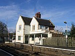
Lockerley
Hampshire geography stubsVillages in Hampshire

Lockerley is a village and civil parish in Hampshire, England on the border with Wiltshire. The village lies on the southern bank of the River Dun about two miles upstream from its confluence with the River Test and about 4 kilometres (2.5 mi) east of West Dean which is just over the Wiltshire border. The parish has a population of around 827 people. The nearest town is Romsey, about 8 kilometres (5 mi) to the south-east and is about 13 miles from Salisbury. The Wessex Main Line railway crosses the parish, the nearest stations being at Dunbridge and West Dean.
Excerpt from the Wikipedia article Lockerley (License: CC BY-SA 3.0, Authors, Images).Lockerley
The Street, Test Valley
Geographical coordinates (GPS) Address Nearby Places Show on map
Geographical coordinates (GPS)
| Latitude | Longitude |
|---|---|
| N 51.032494 ° | E -1.572837 ° |
Address
The Street
SO51 0JF Test Valley
England, United Kingdom
Open on Google Maps


