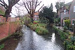
Sulham and Tidmarsh Woods and Meadows

Sulham and Tidmarsh Woods and Meadows is a 75.7-hectare (187-acre) biological Site of Special Scientific Interest west of Reading in Berkshire. Previously known as Pang Valley SSSI, the site is mostly sandwiched between the River Pang and the Sulham Road and includes Broom Copse, Herridge's Copse, Hogmoor Copse, Park Wood, Moor Copse and Barton's Copse. Much of the southern part of the site is the Berkshire, Buckinghamshire and Oxfordshire Wildlife Trust's Moor Copse Nature Reserve. The whole site lies within the North Wessex Downs Area of Outstanding Natural Beauty.The SSSI consists of five areas. The site is in a broad valley of unusually varied alluvial loams, gravel terraces and peat deposits, resulting from flooding in late glacial times by an enlarged River Kennet. The variety in soils and topography results in a mosaic of damp copses and seasonally flooded meadow communities, maintained here by a long history of coppicing and sympathetic grassland husbandry. The woodland on the site supports a rich invertebrate fauna including over 300 species of moth.
Excerpt from the Wikipedia article Sulham and Tidmarsh Woods and Meadows (License: CC BY-SA 3.0, Authors, Images).Sulham and Tidmarsh Woods and Meadows
Sulham Lane,
Geographical coordinates (GPS) Address Website Nearby Places Show on map
Geographical coordinates (GPS)
| Latitude | Longitude |
|---|---|
| N 51.464 ° | E -1.082 ° |
Address
Moor Copse
Sulham Lane
RG8 8DX
England, United Kingdom
Open on Google Maps


