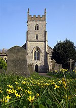
Horfield, Bristol
Areas of BristolCommons category link is locally definedEngvarB from October 2013Former civil parishes in BristolWards of Bristol

Horfield is a suburb of the city of Bristol, in southwest England. It lies on Bristol's northern edge, its border with Filton marking part of the boundary between Bristol and South Gloucestershire. Bishopston lies directly to the south. Monks Park and Golden Hill are to the west. Lockleaze and Ashley Down are on the eastern fringe. The Gloucester Road (A38) runs north–south through the suburb. Horfield is also the name of a ward for Bristol City Council. The ward includes Monks Park and Southmead Hospital, but does not include the southern part of Horfield, including Horfield Common and Horfield Prison, which is in Bishopston ward.
Excerpt from the Wikipedia article Horfield, Bristol (License: CC BY-SA 3.0, Authors, Images).Horfield, Bristol
Filton Grove, Bristol Horfield
Geographical coordinates (GPS) Address Nearby Places Show on map
Geographical coordinates (GPS)
| Latitude | Longitude |
|---|---|
| N 51.49 ° | E -2.5805 ° |
Address
Filton Grove 46
BS7 0AL Bristol, Horfield
England, United Kingdom
Open on Google Maps


