Sugar Loaf, Monmouthshire
Black Mountains, WalesLandmarks in WalesMarilyns of WalesMountains and hills of MonmouthshireSites of Special Scientific Interest in Monmouthshire

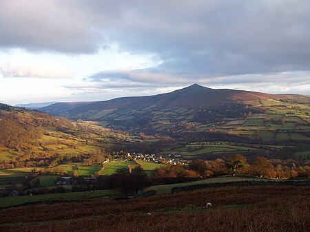
The Sugar Loaf, sometimes called Sugar Loaf (Welsh: Mynydd Pen-y-fâl or Y Fâl), is a hill situated 2 miles (3.2 km) north-west of Abergavenny in Monmouthshire, Wales and sits within the Brecon Beacons National Park. It is the southernmost of the summit peaks of the Black Mountains, with a height of 1,955 feet (596 metres). Sugar Loaf was gifted to the National Trust by suffragette Lady Rhondda.
Excerpt from the Wikipedia article Sugar Loaf, Monmouthshire (License: CC BY-SA 3.0, Authors, Images).Sugar Loaf, Monmouthshire
Geographical coordinates (GPS) Address Nearby Places Show on map
Geographical coordinates (GPS)
| Latitude | Longitude |
|---|---|
| N 51.86211 ° | E -3.05859 ° |
Address
St Mary's Vale
NP7 7EY , Abergavenny
Wales, United Kingdom
Open on Google Maps


