Gaer (Black Mountains)
Black Mountains, WalesHillforts in MonmouthshireHillforts in the Brecon Beacons National ParkMountains and hills of MonmouthshireScheduled monuments in Monmouthshire

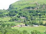
Gaer is the name of a hill in the Black Mountains of the Brecon Beacons National Park in Monmouthshire, south Wales. It lies at the southern end of the long ridge between the valley of the Grwyne Fawr and the Vale of Ewyas one mile to the north of Bryn Arw and 3 miles northeast of Sugarloaf. Its summit at 427m above sea level sits within an Iron Age hillfort known as Twyn y Gaer.
Excerpt from the Wikipedia article Gaer (Black Mountains) (License: CC BY-SA 3.0, Authors, Images).Gaer (Black Mountains)
UCR,
Geographical coordinates (GPS) Address Nearby Places Show on map
Geographical coordinates (GPS)
| Latitude | Longitude |
|---|---|
| N 51.8916 ° | E -3.028 ° |
Address
Twyn y gaer Hill Fort
UCR
NP7 7LU , Crucorney
Wales, United Kingdom
Open on Google Maps


