place

Gambleside

Former populated places in LancashireGeography of the Borough of RossendaleLancashire geography stubsMining in Lancashire
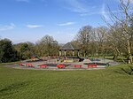
Gambleside Village geograph.org.uk 1123019

Gambleside is an abandoned village located in northern Rossendale close to the boundary with Burnley's Dunnockshaw parish. In the late Middle Ages Gambleside was one of the cow farms (vaccary) of Rossendale Forest, belonging to the Honour of Clitheroe. In 1507 the land was demised as a copyhold to Oliver and George Ormerode at a rent of £4 per year.Historically the Gambleside area stretched from Limy Water southeast over the hills into the valley of Whitewell Brook, including land on the southern side of Clough Bottom Reservoir. It formed part of the township of Higher Booths in the ancient parish of Whalley, which became a civil parish in 1866. In 1894, with the creation of Rawtenstall Municipal Borough this part of Higher Booths was incorporated into it.The settlement was located on a limersgate, a pathway used by pack horses carrying lime, which linked Clitheroe to Rochdale.Gambleside Colliery was established in 1612 and was worked for over 300 years until 1936. It had two main shafts, a winding shaft on the hillside and Pumping Pit.The population began to decline after the building of the Clowbridge Reservoir in 1866, which restricted farming in the village. The Ormerod Family continued to live there until about 1874, with the village abandoned during the 1890s.

Excerpt from the Wikipedia article Gambleside (License: CC BY-SA 3.0, Authors, Images).

Gambleside
Schillstraße, Braunschweig

Geographical coordinates (GPS) Address Website Nearby Places
placeShow on map

Wikipedia: GamblesideContinue reading on Wikipedia

Geographical coordinates (GPS)

Latitude Longitude
N 53.746 ° E -2.259 °
placeShow on map

Address

Schilldenkmal

Schillstraße
38102 Braunschweig (Viewegsgarten- Bebelhof)
Niedersachsen, Deutschland
mapOpen on Google Maps

Website
schillstrasse.de

linkVisit website

Gambleside Village geograph.org.uk 1123019
Share experience

Nearby Places

Singing Ringing Tree (sculpture)

The Singing Ringing Tree is a wind powered sound sculpture resembling a tree set in the landscape of the Pennine hill range overlooking Burnley, in Lancashire, England. Completed in 2006, it is part of the series of four sculptures within the Panopticons arts and regeneration project created by the East Lancashire Environmental Arts Network (ELEAN). The project was set up to erect a series of 21st-century landmarks, or Panopticons (structures providing a comprehensive view), across East Lancashire as symbols of the renaissance of the area. Designed by architects Mike Tonkin and Anna Liu of Tonkin Liu, the Singing Ringing Tree is a 3-metre (10 ft) tall construction comprising pipes of galvanised steel which harness the energy of the wind to produce a slightly discordant and penetrating choral sound covering a range of several octaves. Some of the pipes are primarily structural and visual elements, while others have been cut across their width enabling the sound. The harmonic and singing qualities of the tree were produced by tuning the pipes according to their length by adding holes to the underside of each. In 2007, the sculpture won (along with 13 other candidates) the National Award of the Royal Institute of British Architects (RIBA) for architectural excellence. In March 2017, a second Singing Ringing Tree was set on the outskirts of Austin, Texas in the United States in the rural area of a small town called Manor. While the exact location is unknown, Tonkin Liu also helped in the creation of a third sculpture which is found somewhere in Saudi Arabia. The "Singing Ringing Tree" sculpture was donated to the City of Abilene in July 2022 by its owner in the Austin, Texas, area. The anonymous donor covered the installation and moving costs, which were arranged by the Abilene Cultural Affairs Council. The council contracted with JK Welding to dismantle and reassemble the sculpture, which is composed of nearly 27 tons of pipes, east of the Frontier Texas! museum in the grassy median where Treadaway Boulevard splits and flows into South 1st St. The sculpture's position has been optimized to maximize the wind blowing across the pipes, taking advantage of wind channeled through two nearby underpasses. However, the sculpture is mostly silent in the Abilene location, with director of the Abilene Cultural Affairs Council admitting that “most [visitors] haven’t heard it yet.” The reason why the tubes have failed to consistently produce noise is unknown.

Scott Park
Scott Park

Scott Park is a public park in Burnley, Lancashire. It covers 7.9 hectares (20 acres) and was opened in 1895. Located south of the town centre, attractions include tennis courts, a children's play area, a bandstand, and bowling greens.In the second half of the nineteenth century Burnley's population increased almost five-fold and there was a pressing need for public open space so the council opted to provide recreation grounds with the first of these, Healey Heights located to the west of the park, acquired in 1872. The works provided employment for paupers and several more opened around the town in the following years which proved to be popular.The land that the park occupies was part of the estate of Hood House, which was documented as early as 1563 and was latterly owned by the Halsted family of Rowley Hall. When in 1881, John Hargreaves Scott, a prominent local businessman, an alderman, and Mayor of Burnley in 1871–3, died without an heir, his will specified that upon his wife's death the remaining money be used to create a public park for the town. Mrs Scott died in 1884 and the trustees took some time to decide where to use the £10,000 available (equivalent to at least £1 million as of 2018). In 1892 the decision was finally taken to purchase approximately 7.3 hectares (18 acres) of the Hood House land, with the rest sold for building purposes. By this time Queens Park was under construction and became the town's first public park when it opened the following year.The sloping site is located in the Rose Hill area of Burnley, between Manchester Road to the east and Coal Clough Lane to the west. Scott Park Road which connects the two and bounds the park on the south, was created as part of the development. The principle entry on Scott Park Road at the junction with Albion Street consists of a carriage entrance flanked by pedestrian entrances set between stone gate piers. The other original entrances in the north-west off Fern Road and from the east off Carr Road are similar in style but with a carriage entrance only. A stream enters the site from a valley to the south (Sep Clough) and divides the park.Several curving paths were created, running beside, crossing over, and overlooking the watercourse, with a bandstand, several footbridges and shelters built around the site. A two-storey stone lodge (since demolished) was also constructed next to the main entrance. The park was officially opened on 8 August 1895, and a bowling green was added two years later.A memorial was constructed to Scott and unveiled in 1898. It consists of an elaborate square canopy, mainly in sandstone, with three polished granite colonnettes at each corner. On the top is a central octagonal pillar carrying a flaming urn. Inside the canopy is a pedestal with a marble bust of the donor, which was added the following year. Tennis courts with a pavilion and an additional bowling green were added the early 1900s. Late in the 20th century, the former approximately 0.6-hectare (1.5-acre) site of Lower Hood House, lying between the park and Manchester Road was incorporated in to it.Scott Park is listed as a Grade II public park by English Heritage and has also been awarded the Green Flag Award for its high standards.Incidentally a house on Scott Park Road was in 1939, the first home of the actor Sir Ian McKellen. This was only for a brief time however as his family moved away from the town within months of his birth.