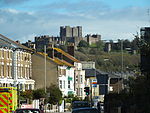
Samphire Hoe
1997 establishments in EnglandCoastal constructionCountry parks in KentDover DistrictProtected areas established in 1997

Samphire Hoe is a country park situated 2 miles (3 km) west of Dover in Kent in southeast England. The park was created by using 4.9 million cubic metres of chalk marl from the Channel Tunnel excavations and is found at the bottom of a section of the White Cliffs of Dover. The site is owned by Getlink, and managed by the White Cliffs Countryside Project.It is accessible by the public via a single-lane road tunnel controlled by traffic lights, which crosses over the South Eastern Main Line that is running in the Shakespeare Cliff tunnel underneath. Visitor facilities are provided, including car parking, toilets and a café.
Excerpt from the Wikipedia article Samphire Hoe (License: CC BY-SA 3.0, Authors, Images).Samphire Hoe
Samphire Road,
Geographical coordinates (GPS) Address Nearby Places Show on map
Geographical coordinates (GPS)
| Latitude | Longitude |
|---|---|
| N 51.1056 ° | E 1.275 ° |
Address
Fishermens Litter
Samphire Road
CT17 9FL , Aycliffe
England, United Kingdom
Open on Google Maps


