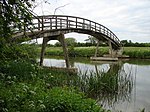
Fyfield, Oxfordshire
Former civil parishes in OxfordshireUse British English from August 2015Vale of White HorseVillages in Oxfordshire

Fyfield is a village and former civil parish, now in the parish of Fyfield and Tubney, in the Vale of White Horse district, in the county of Oxfordshire, England. It is about 4+1⁄2 miles (7 km) west of Abingdon-on-Thames. It was part of Berkshire until the 1974 boundary changes transferred it to Oxfordshire. The village used to be on the main A420 road between Oxford and Faringdon, but a bypass now carries the main road just south of the village. In 1951 the parish had a population of 280. On 1 April 1952 the parish was abolished and merged with Tubney to form "Fyfield and Tubney".
Excerpt from the Wikipedia article Fyfield, Oxfordshire (License: CC BY-SA 3.0, Authors, Images).Fyfield, Oxfordshire
Main Road, Vale of White Horse Fyfield and Tubney
Geographical coordinates (GPS) Address Nearby Places Show on map
Geographical coordinates (GPS)
| Latitude | Longitude |
|---|---|
| N 51.686 ° | E -1.389 ° |
Address
Main Road
OX13 5LW Vale of White Horse, Fyfield and Tubney
England, United Kingdom
Open on Google Maps


