Reka (river)
Croatia geography stubsDrainage basins of the Adriatic SeaEurope river stubsInternational rivers of EuropeNatura 2000 in Slovenia ... and 5 more
Rivers of CroatiaRivers of Inner CarniolaRivers of the Slovene LittoralSinking riversSlovenia geography stubs

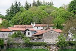
The Reka (literally, 'river' in Slovene), also the Inner Carniola Reka (Slovene: Notranjska Reka), is a river that starts as Big Creek (Croatian: Vela voda) in Croatia, on the southern side of Mount Snežnik, and flows through western Slovenia, where it is also initially known as Big Creek (Velika voda). The river is 54 km (34 mi) long, of which 51 km (32 mi) is in Slovenia. At the village of Škocjan it disappears underground through Škocjan Caves, flowing 38 km (24 mi) underneath the Slovenian Karst. The river continues as part of the Timavo in Italy. Tracer studies have shown that it also feeds springs elsewhere on the Adriatic Coast between Trieste and Monfalcone. It has a pluvial regime.
Excerpt from the Wikipedia article Reka (river) (License: CC BY-SA 3.0, Authors, Images).Reka (river)
Exit 3, Divača
Geographical coordinates (GPS) Address Nearby Places Show on map
Geographical coordinates (GPS)
| Latitude | Longitude |
|---|---|
| N 45.663611111111 ° | E 13.998333333333 ° |
Address
Exit 3
6215 Divača
Slovenia
Open on Google Maps


