place

Earby railway station

1848 establishments in England1970 disestablishments in EnglandBuildings and structures demolished in 1976Disused railway stations in the Borough of PendleFormer Midland Railway stations
North West England railway station stubsPages with no open date in Infobox stationRailway stations in Great Britain closed in 1970Railway stations in Great Britain opened in 1848Use British English from March 2015
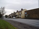
Earby station site geograph 3437588 by Ben Brooksbank

Earby railway station was a junction station that served the town of Earby, in the West Riding of Yorkshire, England. Since 1974 Earby is within the boundaries of the administrative county of Lancashire. The station was built by the Midland Railway, on the former Leeds and Bradford Extension Railway between Skipton and Colne and opened in 1848. The main line continued towards Skipton to the north. South of Earby, in the direction of Colne, there was a junction with a short branch towards Barnoldswick. The latter route succumbed to the Beeching Axe in September 1965, but the station remained open until 2 February 1970, when passenger trains between Colne and Skipton were withdrawn and the line closed to all traffic.The track through the station was lifted the following year, but the platforms and main buildings survived until final demolition in late 1976. The goods shed and former weighbridge still stand, having been bought by a local engineering company and adapted for commercial use whilst the site and former railway alignment have been protected from potential redevelopment by Lancashire County Council pending possible future reinstatement of the route as a transport corridor.

Excerpt from the Wikipedia article Earby railway station (License: CC BY-SA 3.0, Authors, Images).

Earby railway station
Colne Road, Borough of Pendle Earby

Geographical coordinates (GPS) Address Phone number Website Nearby Places
placeShow on map

Wikipedia: Earby railway stationContinue reading on Wikipedia

Geographical coordinates (GPS)

Latitude Longitude
N 53.9126 ° E -2.1478 °
placeShow on map

Address

mph motors earby

Colne Road
BB18 6NQ Borough of Pendle, Earby
England, United Kingdom
mapOpen on Google Maps

Phone number

call+441282843240

Website
mphmotorsearby.co.uk

linkVisit website

Earby station site geograph 3437588 by Ben Brooksbank
Share experience

Nearby Places

Kelbrook
Kelbrook

Kelbrook is a village in the civil parish of Kelbrook and Sough, Borough of Pendle, in Lancashire, England. It lies on the A56 road between Colne and Earby. Historically a part of the now divided old parish of Thornton-in-Craven in the West Riding of Yorkshire, Kelbrook was administered as part of Skipton Rural District, until boundary changes in 1974. Kelbrook lies in West Craven, so keeping cultural links with Yorkshire and Craven. Kelbrook School is in the centre of the village. The tallest building in the village is the village church, St Mary's. Other local towns and villages are Barnoldswick (2 miles/3.2 km northwest), Earby (1 mile/1.6 km north), Salterforth (1 mile/1.6 km northwest), Thornton in Craven {2 miles/3.2 km north), Foulridge (2 miles/3.2 km south) and Colne (3.5 miles/5.6 km south). Elisabeth Beresford, the creator of the Wombles, wrote much of the second Wombles book, The Wandering Wombles, whilst staying in a cottage on Dotcliffe Road in 1970. The Kelbrook and Sough Wombles, a local litter-picking group, is named in tribute to this connection. Edward Woodward lived in Kelbrook for six weeks in 1973 whilst preparing for his role in The Wicker Man. The residents of Kelbrook are affectionately called Kelbricks. During a wedding it is tradition for young residents of the village to lock the church gates and demand money from the bride and groom. A more recent custom is to make scarecrows of literary characters from children's books and to race ducks on Kelbrook Beck.

Thornton-in-Craven railway station

Thornton-in-Craven railway station was a railway station that served the small village of Thornton-in-Craven in North Yorkshire (formerly the West Riding of Yorkshire) England. It was built by the Leeds and Bradford Extension Railway and opened in 1848. It was simply known as Thornton with the in-Craven section not being added to the name until 1937.Situated on the edge of the village and below it, the station closed in 1970 (along with the railway), having previously avoided earlier closure proposals in 1959 and the Beeching Axe of 1963. The closure notice for the villages' railway station was met with indifference as it was pointed out by residents that the bus service was frequent and reliable and the railway station was remote from the village. The service had also been poor in latter years, with just two eastbound and four westbound trains calling each weekday and no calls at all on a Sunday.The last trains ran on Sunday 1 February 1970, with the line closing the next day, Monday 2 February. The track through the station was lifted later that year and the main building on the westbound platform demolished by 1973.The former station house survived demolition and is now privately owned; the trackbed is used as a footpath and bridleway and has a parking area for the nearby cricket ground. The railway between Colne and Skipton is proposed for re-opening to enable a cross-Pennine service and allow residents access to Leeds within one hour. This campaign is being promoted by SELRAP (Skipton East Lancashire Rail Action Partnership.) One of the scoping reports commissioned by SELRAP notes that between Colne and Skipton, there would be only two intermediate stations at Foulridge and Earby. Thornton-in-Craven does not appear as a proposal for reopening.