place

Colliers Wood

All accuracy disputesAreas of LondonDistricts of the London Borough of MertonUse British English from August 2015
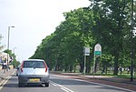
River Wandle and Merton High Street

Colliers Wood is an area in south west London, England, in the London Borough of Merton. It is a mostly residential area, but has a busy high street around Colliers Wood tube station on London Underground's Northern line. The high street is part of the A24, a major road route roughly following the Northern Line, running from London through Tooting and other areas. The Colliers Wood ward had a population of 10,712 in 2011.Colliers Wood shares its postcode district of SW19 with Wimbledon. It merges into Merton Abbey. Colliers Wood has three parks: a recreation ground, the National Trust-owned Wandle Park, which covers an area of approximately 11 acres (45,000 m2), and the more informal Wandle Meadow Nature Park. Colliers Wood United F.C. is a semi-professional football club founded in Colliers Wood but now based in nearby New Malden.

Excerpt from the Wikipedia article Colliers Wood (License: CC BY-SA 3.0, Authors, Images).

Colliers Wood
Devonshire Road, London Collier's Wood (London Borough of Merton)

Geographical coordinates (GPS) Address Nearby Places
placeShow on map

Wikipedia: Colliers WoodContinue reading on Wikipedia

Geographical coordinates (GPS)

Latitude Longitude
N 51.4191 ° E -0.1677 °
placeShow on map

Address

Devonshire Road 51
SW19 2EJ London, Collier's Wood (London Borough of Merton)
England, United Kingdom
mapOpen on Google Maps

River Wandle and Merton High Street
Share experience

Nearby Places

St Barnabas' Church, Mitcham

St Barnabas' Church, Mitcham, is a church in the Graveney ward of the London borough of Merton, in SW London. It is located on Gorringe Park Avenue in Mitcham. The church is dedicated to Barnabas, one of the disciples. In his day, he carried out missionary journeys & had a great ability to encourage - Barnabas means "son of encouragement". The dedication was chosen, due to the missionary nature of the church set up on this site. The local area in the early 20th Century was a Mission District (specifically, from 1906), where the church aimed to establish & foster a local religious community. This was at the aegis of Christ Church in Colliers Wood, along with old boys from City of London School. The initial missionary building was a basic building, housing a single room; it was known as the "tin church". The current building that we know was designed by H. P. Burke Downing, the foundation stone being laid on 17 May 1913 & the church was completed on 14 November 1914. The church was Grade II listed by English Heritage on 2 September 1988.No images of this early "tin church" are available, but we can ascertain how it might have looked with images of other churches which shared a similar arc of development, starting in newly populated areas in the greatly expanding cities of the late 1800s and early 1900s. Possible examples being the "tin hut" church at Mile Oak or the tabernacles of the Methodist ChurchRecently, the church has been used as a polling station for elections; it was used as a polling office in UK General Election of 12 December 2019, with the polling booths and election officers being located near the main door.