place

Bakerloo line extension

Abandoned London Underground projectsProposed extensions to the London UndergroundProposed rail infrastructure in LondonTransport in the London Borough of BromleyTransport in the London Borough of Lewisham
Transport in the London Borough of SouthwarkUse British English from April 2017
London Underground proposed Bakerloo line extension map

The Bakerloo line extension is a proposed extension of the London Underground Bakerloo line in South London from its current terminus at Elephant & Castle to Lewisham station.An extension southwards from Elephant & Castle was considered as early as 1913, with a formal proposal to extend to Camberwell in the late 1940s. Since the late 2000s, Transport for London (TfL) has been planning an extension of the line, with a route to Lewisham via Old Kent Road safeguarded in 2021. TfL has also proposed taking over services on the Hayes line to Hayes and Beckenham Junction, which could occur following the completion of the extension to Lewisham.The London Underground extension would serve areas of Southeast London with low levels of public transport availability, improving accessibility and reducing journey times. The extension would also support regeneration and housing development in the area. Estimated to cost between £4.7bn to £7.9bn (in 2017 prices), the extension would take around 7 years to construct. Due to financial impacts of the COVID-19 pandemic, work to implement the extension is currently on hold.

Excerpt from the Wikipedia article Bakerloo line extension (License: CC BY-SA 3.0, Authors, Images).

Bakerloo line extension
Newington Causeway, London Elephant and Castle (London Borough of Southwark)

Geographical coordinates (GPS) Address Nearby Places
placeShow on map

Wikipedia: Bakerloo line extensionContinue reading on Wikipedia

Geographical coordinates (GPS)

Latitude Longitude
N 51.496 ° E -0.101 °
placeShow on map

Address

Skipton House

Newington Causeway
SE1 6DQ London, Elephant and Castle (London Borough of Southwark)
England, United Kingdom
mapOpen on Google Maps

London Underground proposed Bakerloo line extension map
Share experience

Nearby Places

Elephant and Castle
Elephant and Castle

The Elephant and Castle is an area around a major road junction in London, England, in the London Borough of Southwark. The name also informally refers to much of Walworth and Newington, due to the proximity of the London Underground station of the same name. The name is derived from a local coaching inn. In the first half of the 20th century, because of its vitality, the area was known as "the Piccadilly of South London". In more recent years is now viewed as a part of central London given its location in Zone 1 on the London Underground. "The Elephant", as locally abbreviated, consists of major traffic junctions connected by a short road called Elephant and Castle, the nascent part of the A3. Traffic runs to and from Kent along the A2 (New Kent Road and Old Kent Road), much of the south of England on the A3, to the West End via St George's Road, and to the City of London via London Road and Newington Causeway at the northern junction. Newington Butts and Walworth Road adjoin the southern junction. The whole junction forms part of the London Inner Ring Road and part of the boundary of the London congestion charge zone. The subterranean River Neckinger, which originates from the Geraldine Mary Harmsworth Park area, flows east directly under the area towards St Saviour's Dock where it enters the Thames. The area was significantly remodelled in the 1960s as part of the post-war reconstruction. A new and major wave of redevelopment was initiated in the late 2000s with the demolition of the brutalist Heygate Estate. The various phases of the project are due to last until the late 2020s. The demolition of the shopping centre and The Coronet started in early 2021. The Elephant has two linked London Underground stations, on the Northern and Bakerloo lines, and a National Rail station served by limited Southeastern services and Thameslink suburban loop line services to Mitcham, Sutton and Wimbledon, and services to Kentish Town and St.Albans to Orpington or Sevenoaks via Catford.

Stanley Kubrick Archive

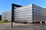
The Stanley Kubrick Archive is held by the University of the Arts London in their Archives and Special Collection Centre at the London College of Communication. The Archive opened in October 2007 and contains material collected and owned by the film director Stanley Kubrick (1928–1999). It was transferred from his home in 2007 through a gift by his family. It contains much of Kubrick's working material that was accumulated during his lifetime. The collection spans Kubrick’s career as a photographer for Look and as a film director. His films are: Fear and Desire, Killer's Kiss, The Killing, Paths of Glory, Spartacus, Lolita, Dr. Strangelove or: How I Learned to Stop Worrying and Love the Bomb, 2001: A Space Odyssey, A Clockwork Orange, Barry Lyndon, The Shining, Full Metal Jacket and Eyes Wide Shut. Kubrick also planned to make a number of other films two in particular were abandoned just before production, Napoleon and The Aryan Papers. He also played an important role in the conception of AI: Artificial Intelligence, although it was completed after his death by Steven Spielberg. The collection held by the University is made up of a range of material including props, scripts, research, production paperwork such as call sheets, costumes and photographs for all his films and Look, as well as material for those projects that were conceived but never visualised. By maintaining a high degree of control in the film making process, Kubrick was able to retain material generated by his pioneering techniques, research and production work: arguably making this collection one of the most complete examples of film making practice worldwide.Items from the archive are on loan for the touring Stanley Kubrick Exhibition.

Metro Central Heights

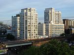
Metro Central Heights is a group of residential buildings in Walworth in the London Borough of Southwark. It was originally known as Alexander Fleming House, a multi-storey office complex designed by Hungarian-born modernist architect Ernő Goldfinger and constructed in the early 1960s for Arnold Lee of Imry Properties. The design was favoured both by the property developer Imry and by the London County Council as it promised the largest amount of lettable space and therefore the best financial return for the site. Some 55 m tall at its highest point, the original scheme consisted of three freestanding blocks, two of seven storeys and one of eighteen, grouped around a central piazza. It is located on Newington Causeway on the east side of the busy Elephant and Castle junction in inner south-east London. Ernő Goldfinger proposed three main components of modern architecture, "the permanent structure; the much less permanent services and an even more fleeting component, the human requirements". These applied directly to the development where its eventual use was not known at the time of construction. Therefore, the internal design of the building was made as flexible as possible, providing open decks which could be readily subdivided and services re-routed. The building's original tenant was the Department of Health and Social Security, known as the Ministry of Health at the time, which probably led to its being named Alexander Fleming House, after the discoverer of penicillin. The development became its headquarters, and shortly afterwards Ernő Goldfinger was commissioned to design two additional blocks, D and E. The building received a Civic Trust Award in 1964.The Health Department's headquarters became notorious for sick building syndrome and the DHSS civil servants were moved out in the early 1990s to a new headquarters across the road, first of all to Hannibal House and then Skipton House. The Executive staff moved to new headquarters on Whitehall, Richmond House. The design flexibility served the building well when it was saved from demolition and converted into a residential development and renamed "Metro Central Heights" by St George Plc (a division of Berkeley Group Holdings) in 1997. It was narrowly missed off English Heritage's roll of post-war buildings worthy of listing around the same time. The conversion cured the sick building syndrome, and added a gym and swimming pool to the complex. It now contains some 400 studio to three-bedroom flats which are in constant demand, especially by "young urban professionals" who value Elephant and Castle's proximity to the City and West End. Planning permission was granted on appeal for a further 15-storey block by St George Plc named Vantage Metro Central on what was formerly the development's surface car park in February 2004. This was completed in late 2008. This had originally been the site of both the Odeon cinema, also designed by Ernő Goldfinger but demolished by Imry in 1988, and the huge Trocadero cinema that was cleared for blocks D and E of the development itself. Metro Central Heights became a listed building on 9 July 2013, when the Minister for Culture, Ed Vaizey MP accepted English Heritage's recommendation that it should be listed at Grade II.