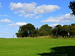
Thorpe Thewles
Borough of Stockton-on-TeesCounty Durham geography stubsNorth Yorkshire geography stubsVillages in County Durham

Thorpe Thewles is a village which had history dating back to the 12th century. The village shares a parish with Grindon and is in the Borough of Stockton-on-Tees, County Durham, Northern England. It lies near the A177 road between Stockton-on-Tees and Sedgefield.
Excerpt from the Wikipedia article Thorpe Thewles (License: CC BY-SA 3.0, Authors, Images).Thorpe Thewles
Wynyard Road,
Geographical coordinates (GPS) Address Nearby Places Show on map
Geographical coordinates (GPS)
| Latitude | Longitude |
|---|---|
| N 54.6 ° | E -1.3833333333333 ° |
Address
Wynyard Road
Wynyard Road
TS21 3LB
England, United Kingdom
Open on Google Maps


