Rosendaël
DunkirkFormer communes of Nord (French department)French FlandersNord (French department) geography stubsPages with French IPA

Rosendaël (French pronunciation: [ʁozɑ̃dal]; Dutch: Rozendaal; West Flemish: Rozendoale; French Flemish: Roozendaele; meaning "rose valley") is a former commune in the Nord department in northern France. In 1971 it was merged into Dunkirk. It currently has 18,272 inhabitants (an almost ten-fold increase since 1825) in an area of 3.97 km2.
Excerpt from the Wikipedia article Rosendaël (License: CC BY-SA 3.0, Authors, Images).Rosendaël
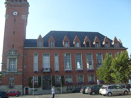
Place des Martyrs de la Résistance, Dunkirk Rosendaël (Dunkerque)
Geographical coordinates (GPS) Address Nearby Places Show on map
Geographical coordinates (GPS)
| Latitude | Longitude |
|---|---|
| N 51.0413 ° | E 2.4037 ° |
Address
Mairie annexe de Rosendaël
Place des Martyrs de la Résistance
59240 Dunkirk, Rosendaël (Dunkerque)
Hauts-de-France, France
Open on Google Maps


