place

Marfleet railway station

Beeching closures in EnglandDisused railway stations in Kingston upon HullFormer North Eastern Railway (UK) stationsHull and Holderness RailwayPages with no open date in Infobox station
Railway stations in Great Britain closed in 1964Railway stations in Great Britain opened in 1854Use British English from January 2018Yorkshire and the Humber railway station stubs
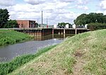
Railway, Marfleet, Yorkshire (geograph 3278197)

Marfleet railway station is a disused railway station on the North Eastern Railway's Hull and Holderness Railway in the Marfleet area of the city of Hull in the East Riding of Yorkshire, England. It was opened by the Hull and Holderness Railway on 27 June 1854. The station was closed to passengers on 19 October 1964 and to freight on 1 May 1972.

Excerpt from the Wikipedia article Marfleet railway station (License: CC BY-SA 3.0, Authors, Images).

Marfleet railway station
Marfleet Lane, Hull Marfleet

Geographical coordinates (GPS) Address External links Nearby Places
placeShow on map

Wikipedia: Marfleet railway stationContinue reading on Wikipedia

Geographical coordinates (GPS)

Latitude Longitude
N 53.753 ° E -0.272 °
placeShow on map

Address

Marfleet

Marfleet Lane
HU9 5RN Hull, Marfleet
England, United Kingdom
mapOpen on Google Maps

linkWikiData (Q6759042)
linkOpenStreetMap (8674210406)

Railway, Marfleet, Yorkshire (geograph 3278197)
Share experience

Nearby Places

Holderness Drain
Holderness Drain

Holderness Drain is the main feature of a Land Drainage scheme for the area of Holderness to the east of the River Hull in the East Riding of Yorkshire, England. Construction began in 1764, and several notable civil engineers were involved with the scheme over the years. Despite the high costs of the initial scheme, it was not particularly successful, because of the refusal of the ship owners of Hull to allow an outlet at Marfleet. They insisted that the water be discharged into the River Hull to keep the channel free of silt. Following a period of agricultural depression and the building of new docks in the early 1800s, an outlet at Marfleet was finally authorised in 1832. A high level system still fed upland water to the Hull, but the low level system discharged into the Humber, where levels were considerably lower. Following the success of steam pumping on the Beverley and Barmston Drain, the trustees looked at such a possibility for the Holderness Drain, but the development of the Alexandra Dock in the 1880s and then the King George V Dock in 1913 provided a solution, as the docks were topped up with water pumped from the drain, to lessen the ingress of silt-laden water. Responsibility for the scheme rested with the Trustees of Holderness Drainage from its inception in 1764 until 1930, when a major overhaul of land drainage legislation took place. Since then it has been managed by a catchment board, a river board, a river authority, a water authority, the National Rivers Authority and the Environment Agency. Since 1930, the smaller drainage ditches that feed into the Holderness Drain have been the responsibility of an internal drainage board. In order to improve the efficiency of the system, pumping stations were built at Tickton, Great Culvert and East Hull in 1972. However, attitudes to land drainage have changed and the Tickton station is now deemed to be uneconomic, and will be closed down unless alternative sources of income to fund its operation can be found.