Marfleet
OpenDomesdayUse British English from March 2017Wards and districts of Kingston upon Hull
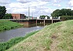
Marfleet is an area of Kingston upon Hull, East Riding of Yorkshire, England, in the east of the city, near King George Dock. Marfleet was until the late 20th century a small village outside the urban area of Hull – developments including the Hull and Holderness Turnpike (1833), the Hull and Holderness Railway (1854) and the King George Dock (1914), as well as establishments of factories in the area from the late 19th century onwards (notably one by H. H. Fenner & Co., c. 1893) caused the development of the area into an industrial suburb. Parts of the former village, including the church still exist, isolated within the predominately industrial landscape.
Excerpt from the Wikipedia article Marfleet (License: CC BY-SA 3.0, Authors).Marfleet
Stockwell Grove, Hull Greatfield
Geographical coordinates (GPS) Address Nearby Places Show on map
Geographical coordinates (GPS)
| Latitude | Longitude |
|---|---|
| N 53.7512 ° | E -0.2636 ° |
Address
Stockwell Grove
HU9 5JS Hull, Greatfield
England, United Kingdom
Open on Google Maps


