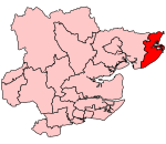
Kirby-le-Soken
Essex geography stubsFormer civil parishes in EssexTendringVillages in Essex

Kirby-le-Soken is a village and former civil parish, now in the parish of Frinton and Walton, in the Tendring district of North East Essex, England, which is mainly agricultural, but increasingly residential, near Frinton-on-Sea and Walton-on-the-Naze. In 2018 the built-up-area had an estimated population of 1387. In 1931 the parish had a population of 836. On 1 April 1934, the parish was abolished to form "Frinton and Walton", part also went to Thorpe-le-Soken.Kirby-le-Soken is in an area called The Sokens, isolated from Kirby Cross, Frinton-on-Sea, and Walton-on-the-Naze by fields.
Excerpt from the Wikipedia article Kirby-le-Soken (License: CC BY-SA 3.0, Authors, Images).Kirby-le-Soken
Horsey Road, Essex
Geographical coordinates (GPS) Address Nearby Places Show on map
Geographical coordinates (GPS)
| Latitude | Longitude |
|---|---|
| N 51.851 ° | E 1.225 ° |
Address
Horsey Road 2
CO13 0DZ Essex, Frinton and Walton
England, United Kingdom
Open on Google Maps


