place

Winchester Castle F.C.

2006 establishments in EnglandAssociation football clubs established in 2006Defunct football clubs in EnglandDefunct football clubs in HampshireHampshire League
Hampshire League 2004Hampshire Premier LeagueNorth Hants LeagueSport in WinchesterWessex Football League
WIncastlefc
WIncastlefc

Winchester Castle F.C. were a long running English amateur football team based in Winchester. They played in the Hampshire League for over 50 years before their untimely demise.

Excerpt from the Wikipedia article Winchester Castle F.C. (License: CC BY-SA 3.0, Authors, Images).

Winchester Castle F.C.
Chilcomb Lane, Winchester Bar End

Geographical coordinates (GPS) Address Nearby Places
placeShow on map

Wikipedia: Winchester Castle F.C.Continue reading on Wikipedia

Geographical coordinates (GPS)

Latitude Longitude
N 51.053552777778 ° E -1.3019111111111 °
placeShow on map

Address

Chilcomb Lane
SO23 8RB Winchester, Bar End
England, United Kingdom
mapOpen on Google Maps

WIncastlefc
WIncastlefc
Share experience

Nearby Places

Hampshire
Hampshire

Hampshire (, ; abbreviated to Hants.) is a ceremonial county in South East England. It is bordered by Berkshire to the north, Surrey and West Sussex to the east, the Isle of Wight across the Solent to the south, Dorset to the west, and Wiltshire to the north-west. The city of Southampton is the largest settlement, and the county town is the city of Winchester. The county has an area of 3,769 km2 (1,455 sq mi) and a population of 1,844,245, making it the 5th-most populous in England. The South Hampshire built-up area in the south-east of the county has a population of 855,569 and contains the cities of Southampton (269,781) and Portsmouth (208,100). In the north-east, the Farnborough/Aldershot conurbation extends into Berkshire and Surrey and has a population of 252,937. The next-largest settlements are Basingstoke (113,776), Andover (50,887), and Winchester (45,184). The centre and south-west of the county are rural. The county contains thirteen local government districts; eleven are part of Hampshire, a two-tier non-metropolitan county, and the districts of Portsmouth and Southampton are part of unitary authority areas. The county historically contained the towns of Bournemouth and Christchurch, which are now part of Dorset and the Isle of Wight. Undulating hills characterise much of the county. A belt of chalk crosses the county from north-west, where it forms the Hampshire Downs, to south-east, where it is part of the South Downs. The county's major rivers rise in these hills; the Loddon and Wey drain north, into the Thames, and the Itchen and Test flow south into Southampton Water, a large estuary. In the south-east are Portsmouth Harbour, Langstone Harbour, and the western edge of Chichester Harbour, three large rias. The south-west contains the New Forest, which includes pasture, heath, and forest and is of the largest expanses of ancient woodland remaining in England. Settled about 14,000 years ago, Hampshire's recorded history dates to Roman Britain, when its chief town was Venta Belgarum (now Winchester). The county was recorded in Domesday Book as divided into 44 hundreds. From the 12th century, the ports settlements grew due to increasing trade with the European mainland resulting from the wool and cloth, fishing, and shipbuilding industries. This meant by the 16th century, Southampton had become more populous than Winchester. In 20th century conflicts, including World War One and Two, Hampshire played a crucial military role due to its ports.

Itchen Navigation
Itchen Navigation

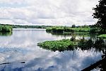
The Itchen Navigation is a 10.4-mile (16.7 km) disused canal system in Hampshire, England, that provided an important trading route from Winchester to the sea at Southampton for about 150 years. Improvements to the River Itchen were authorised by Act of Parliament in 1665, but progress was slow, and the navigation was not declared complete until 1710. It was known as a navigation because it was essentially an improved river, with the main river channel being used for some sections, and cuts with locks used to bypass the difficult sections. Its waters are fed from the River Itchen. It provided an important method of moving goods, particularly agricultural produce and coal, between the two cities and the intervening villages. On its completion it was capable of taking shallow barges of around 13 feet (4.0 m) in width and 70 feet (21 m) in length, but traffic was fairly modest. 18,310 tons of freight were carried in 1802, one of the better years, and there were never more than six boats in use on the waterway. Following the opening of the London and Southampton Railway in 1840, traffic declined sharply, and the navigation ceased to operate in 1869. There were various attempts to revitalise it, but none were successful. There had also been several proposals to link it to the Basingstoke Canal to form an inland route from London to Southampton during its life, which likewise did not come to fruition. The revival of interest in inland waterways following the end of the Second World War has resulted in the tow path alongside the canal becoming part of the Itchen Way long-distance footpath, and is a popular route for walkers. The Itchen Navigation Preservation Society was formed in the 1970s, but progress was slow. A joint venture between the Environment Agency and the Hampshire and Isle of Wight Wildlife Trust in 2005 led to the formation of the Itchen Navigation Trust, and two years later, they obtained a grant from the Heritage Lottery Fund, funding the creation of the Itchen Navigation Heritage Trail Project, which has sought to conserve and interpret the remains. The route provides habitat for a diverse flora and fauna, which has resulted in it being designated as a European Special Area of Conservation and a Site of Special Scientific Interest.