place

Spree (river)

Border riversCzech Republic–Germany borderFederal waterways in GermanyInternational rivers of EuropeRivers of Berlin
Rivers of BrandenburgRivers of GermanyRivers of SaxonyRivers of the Ústí nad Labem RegionSpree basinTributaries of the Havel
Berlin Bundestag by the Spree 3570

The Spree (German: [ˈʃpʁeː] (listen); Sorbian languages: Sprjewja, Czech: Spréva) is, with a length of approximately 400 kilometres (250 mi), the main tributary of the River Havel. The Spree is much longer than the Havel, which it flows into at Berlin-Spandau; the Havel then flows into the Elbe at Havelberg. The river rises in the Lusatian Highlands, that are part of the Sudetes, in the Lusatian part of Saxony, where it has three sources: the historical one called Spreeborn in the village of Spreedorf, the water-richest one in Neugersdorf, and the highest elevated one in Eibau. The Spree then flows northwards through Upper and Lower Lusatia, where it crosses the border between Saxony and Brandenburg. After passing through Cottbus, it forms the Spree Forest, a large inland delta and biosphere reserve. It then flows through Lake Schwielochsee before entering Berlin, as Müggelspree (listen ). The Spree is the main river of Berlin, Brandenburg, Lusatia, and the settlement area of the Sorbs, who call the River Sprjewja. For a very short distance close to its sources, the Spree constitutes, as Spréva, the border between Germany (Saxony), and the Czech Republic (Bohemia). The Spree's longest tributaries are Dahme (confluence in Berlin-Köpenick) and Schwarzer Schöps (confluence in Sprey), other well-known tributaries (since they are Berlin rivers) are Panke and Wuhle.

Excerpt from the Wikipedia article Spree (river) (License: CC BY-SA 3.0, Authors, Images).

Spree (river)
Obermeierweg, Berlin Spandau

Geographical coordinates (GPS) Address Nearby Places
placeShow on map

Wikipedia: Spree (river)Continue reading on Wikipedia

Geographical coordinates (GPS)

Latitude Longitude
N 52.536111111111 ° E 13.208611111111 °
placeShow on map

Address

Obermeierweg 18
13597 Berlin, Spandau
Germany
mapOpen on Google Maps

Berlin Bundestag by the Spree 3570
Share experience

Nearby Places

Altstadt Spandau
Altstadt Spandau

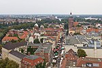
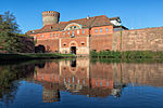
Altstadt Spandau is the historic centre (old town) of the Spandau borough in the western suburbs of Berlin, situated on the right bank of the Havel river by its confluence with the Spree tributary. It arose near the site of a former Slavic gord during the German eastward expansion (Ostsiedlung) in the early 13th century. A castle at Spandowe, erected on a Havel island to secure the eastern borderlands of the Margraviate of Brandenburg, was already documented in an 1197 deed issued by the Ascanian margrave Otto II. The city itself was first mentioned on 7 March 1232, when the Spandau citizens were vested with further privileges by the Brandenburg margraves John I and Otto III. A first church is documented in 1240; the present-day Saint Nicholas Church was built in the late 14th century. It became the initial point of the Protestant Reformation in Brandenburg, when on 1 November 1539 Elector Joachim II Hector converted to Lutheranism and celebrated the first communion under both kinds here. A Jewish community in Spandau existed since the 13th century, a synagogue is documented since 1342. The Hohenzollern elector also had the city protected from attacks by the Spandau Citadel, a Renaissance fortress erected at the site of the medieval castle from about 1560 onwards. The walled-up Altstadt quarter became the nucleus of the larger Spandau Fortress, built under Prussian rule after the Napoleonic Wars in the early 19th century, also a centre of the German arms industry. Today the Altstadt quarter is served by Rathaus Spandau and Altstadt Spandau stations on the Berlin U-Bahn line . Berlin-Spandau station, served by S-Bahn, regional and intercity railway routes, is situated to the south of the Altstadt.

Rathaus Spandau (Berlin U-Bahn)

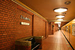
Rathaus Spandau (Spandau Town Hall) is one of the western termini of Berlin U-Bahn line U7 (the other one being Rudow). It was opened on 1 October 1984 with the line's extension from Rohrdamm to Rathaus Spandau. The station takes its name from the nearby Rathaus Spandau, the historic city hall of Spandau. Close to the U-Bahn station Rathaus Spandau is the Berlin-Spandau station of the Berlin S-Bahn line S5 and the Deutsche Bahn for regional and intercity transport. The next station on the U7 line is Altstadt Spandau.The station was built in a box under a cover in order to minimise the disturbance of surface traffic. With its two island platforms, the station, which was designed by Rainer G. Rümmler, has almost monumental dimensions. It has a big hall with high ceilings, much light and 64 lamps, columns with black granite and a parquet floor like floor. The southern end of its platforms are spanned by a gallery for the movement of passengers to the surface and from which the entire station can be seen. The U-Bahn station also includes a signal control centre for the line to Paulsternstraße. U-Bahn line U7 uses the inner tracks, which are built for large profile trains, while the track beds of the outer tracks, which are built for the operation of small profile trains on a planned extension of the U-Bahn line U2, which currently runs only as far as Ruhleben, are currently empty. Uniquely for the Berlin U-Bahn, this line would run to the left of the platforms to improve interchanges for the planned extensions of the U7 to Staaken and the U2 to Falkenhagener Feld. An extension of the U7 south to Heerstraße is currently being planned, with a projected completion date in the mid-2030s. In 2021, the 4.26km, 5-station extension was projected to cost €578 million. Although the station is very close to Spandau S-Bahn station, it has kept its name. Nevertheless, Berliner Verkehrsbetriebe buses always show the destination as S+U Rathaus Spandau, but the S-Bahn station is only signed as Spandau.

Bullengraben
Bullengraben

The Bullengraben is a moat in Berlin’s glacial valley, which has been in use since the 7th century. It is located in the Berlin district of Spandau and runs from the old village center of Staaken eastwards for about five kilometers to the Havel River, into which it flows north of the Spandau castle rampart. Used for centuries to improve the wetlands, since the 1960s it has been used as a drainage ditch to collect rainwater from the surrounding neighborhoods of Spandau. The development of the areas around the Bullengraben reflects part of Spandau's settlement history. Between 2004 and 2007, DB ProjektBau rehabilitated a ditch that had been canalized in the 1960s and 1970s but had later been neglected. This rehabilitation was conducted as part of a replacement measure. Parallel to the moat, the Deutsche Bahn subsidiary created the 200-meter-wide Bullengraben/Lindenufer green corridor with playgrounds and sports fields, recreational areas, bridges, footbridges, and a path that leads to Elsflether Weg. The Bullengrabenweg, one of Berlin's top 20 green paths, is open to pedestrians, cyclists, and skaters. The path is approximately four meters wide and has a smooth asphalt covering. The last section of the path includes the Burgwallgraben and a 100-metre-long promenade along the Havel. Additionally, biotopes located within the green corridor, such as the Stieglake and Wiesen basins, along with the ditches leading to them, such as the Egelpfuhlgraben, have undergone restoration. In 2008, Deutsche Bahn received the Gustav Meyer Prize for designing the entire park. This award is given every two years since 1995 to recognize excellent planning of public green spaces and parks. The prize bears the name of Johann Heinrich Gustav Meyer, Berlin's first municipal horticultural director.