La Combe-de-Lancey
Communes of IsèreIsère geography stubsPages with French IPA

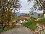
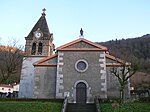
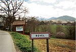
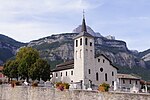
La Combe-de-Lancey (French pronunciation: [la kɔ̃b də lɑ̃sɛ]) is a commune in the Isère department in Auvergne-Rhône-Alpes region in southeastern France. The municipality covers an area of over 1,800 hectares. Located in the heart of the Belledonne, the town is bordered by Revel, Saint-Jean-le-Vieux, and Saint-Mury-Monteymond.
Excerpt from the Wikipedia article La Combe-de-Lancey (License: CC BY-SA 3.0, Authors, Images).La Combe-de-Lancey
Route de la Chapelle, Grenoble
Geographical coordinates (GPS) Address Nearby Places Show on map
Geographical coordinates (GPS)
| Latitude | Longitude |
|---|---|
| N 45.2267 ° | E 5.8986 ° |
Address
Route de la Chapelle
38190 Grenoble
Auvergne-Rhône-Alpes, France
Open on Google Maps


