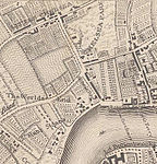
World's End, Kensington and Chelsea
Areas of LondonDistricts of the Royal Borough of Kensington and ChelseaKing's Road, Chelsea, LondonUse British English from September 2015

World's End is a district of Chelsea, London, lying at the western end of the King's Road. Once a Victorian slum area, council housing was built here in the 20th century, including the brutalist architecture World's End estate.
Excerpt from the Wikipedia article World's End, Kensington and Chelsea (License: CC BY-SA 3.0, Authors, Images).World's End, Kensington and Chelsea
Slaidburn Street, London World's End (Royal Borough of Kensington and Chelsea)
Geographical coordinates (GPS) Address Nearby Places Show on map
Geographical coordinates (GPS)
| Latitude | Longitude |
|---|---|
| N 51.482 ° | E -0.181 ° |
Address
Slaidburn Street
Slaidburn Street
SW10 0JP London, World's End (Royal Borough of Kensington and Chelsea)
England, United Kingdom
Open on Google Maps


