Wattwiller
Communes of Haut-RhinHaut-Rhin geography stubs

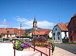
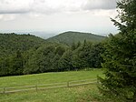
Wattwiller (Alemannic German: Wǎttwillr; German: Wattweiler) is a commune in the Haut-Rhin department of the Grand Est region, which lies in the north-eastern part of France. Located near the Vosges mountain rocky spur of Hartmannswillerkopf, Wattwiller was a strategic village in the Alsace, and suffered attacks in or near it during the Thirty Years' War and in both World Wars. Nowadays Wattwiller is best known for its mineral water.
Excerpt from the Wikipedia article Wattwiller (License: CC BY-SA 3.0, Authors, Images).Wattwiller
Impasse du Lavoir, Thann-Guebwiller
Geographical coordinates (GPS) Address Nearby Places Show on map
Geographical coordinates (GPS)
| Latitude | Longitude |
|---|---|
| N 47.8369 ° | E 7.1808 ° |
Address
Impasse du Lavoir 9
68700 Thann-Guebwiller
Grand Est, France
Open on Google Maps


