Whitfield, Northamptonshire
Civil parishes in NorthamptonshireNorthamptonshire geography stubsUse British English from March 2014Villages in NorthamptonshireWest Northamptonshire District

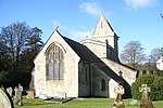
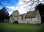
Whitfield is a village and parish in the south-west of the English county of Northamptonshire in the valley of the River Great Ouse which forms the border with Buckinghamshire. Nearby villages include Syresham, Biddlesden, Helmdon and Silverstone. At the time of the 2001 census, the parish had 215 inhabitants, including Radstone and increasing to 274 at the 2011 Census.The Church of England parish church is dedicated to St John the Evangelist and is a Grade II listed building, built in 1870. The original church, built in the 13th century, was damaged by a heavy gale on 1 February 1869, which blew down the west tower, which required it to be rebuilt entirely.
Excerpt from the Wikipedia article Whitfield, Northamptonshire (License: CC BY-SA 3.0, Authors, Images).Whitfield, Northamptonshire
A43,
Geographical coordinates (GPS) Address Nearby Places Show on map
Geographical coordinates (GPS)
| Latitude | Longitude |
|---|---|
| N 52.0506 ° | E -1.1192 ° |
Address
A43
NN13 7TY
England, United Kingdom
Open on Google Maps


