place

Kapelle-op-den-Bos

Flemish Brabant geography stubsMunicipalities of Flemish Brabant
Kapelle op den BosLocatie

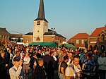
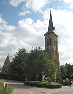
Kapelle-op-den-Bos (Dutch pronunciation: [kaːˌpɛlə ʔɔb dɛm ˈbɔs]) is a municipality located in the Belgian province of Flemish Brabant. The municipality comprises the towns of Kapelle-op-den-Bos proper, Nieuwenrode and Ramsdonk. On January 1, 2006, Kapelle-op-den-Bos had a total population of 8,904. The total area is 15.25 km² which gives a population density of 584 inhabitants per km². Located at the intersection of the Willebroek to Brussels shipping canal and the Mechelen-Ghent railway line, the town is home to the Etex Group NV group of companies, which manufacture piping, roofing, gyprock and cement products. Numerous other industrial companies call Kapelle-op-den-Bos home, and the General Secondary College Sint-Theresia College (STK) has a wide catchment extending beyond municipal boundaries. The town was a target for heavy bombing during the First World War due to its proximity to transport routes. Among the many buildings destroyed was the parish church of St. Nicholas, which was later rebuilt with a modern flavour; the nave retained its original arched windows, but the steeple now appears as a crown. Kapelle-op-den-Bos is heavily polluted with asbestos. Many inhabitants of the village died due to this mortal pollution. Health problems caused by the asbestos pollution still remain a major problem for the whole area.

Excerpt from the Wikipedia article Kapelle-op-den-Bos (License: CC BY-SA 3.0, Authors, Images).

Kapelle-op-den-Bos
Leiweg,

Geographical coordinates (GPS) Address Nearby Places
placeShow on map

Wikipedia: Kapelle-op-den-BosContinue reading on Wikipedia

Geographical coordinates (GPS)

Latitude Longitude
N 51.016666666667 ° E 4.3666666666667 °
placeShow on map

Address

Leiweg 31
1880 (Kapelle-op-den-Bos)
Flemish Brabant, Belgium
mapOpen on Google Maps

Kapelle op den BosLocatie
Share experience

Nearby Places

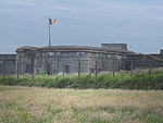
Fort Breendonk
Fort Breendonk

Fort Breendonk (Dutch: Fort van Breendonk, French: Fort de Breendonk) is a former military installation at Breendonk, near Mechelen, in Belgium which served as a Nazi prison camp (Auffanglager) during the German occupation of Belgium during World War II. Originally constructed between 1906 and 1913 as part of the second ring of the National Redoubt defending Antwerp, Fort Breendonk was used by the Belgian Army and was covered by a five-metre thick layer of soil for defense against artillery fire, a water-filled moat and measured 656 by 984 feet (200 by 300 m). It was used in both World War I and World War II by which time it had become militarily obsolete. Fort Breendonk was requisitioned by the Schutzstaffel (SS) shortly after the Belgian surrender on 28 May 1940 and used as a prison camp for the detention of political prisoners, resistance members, and Jews. Although technically a prison rather than a concentration camp, it became infamous for the poor living conditions in which the prisoners were housed and for the torture and executions which were carried out there. Most detainees were subsequently transferred to larger concentration camps in Eastern Europe. 3,590 prisoners are known to have been held at Fort Breendonk during the war of whom 303 died or were executed in the fort itself while 1,741 others subsequently died in other camps before the end of the war. In Belgian historical memory, Breendonk became symbolic of the barbarity of the German occupation. The camp was evacuated ahead of the Liberation of Belgium by the Western Allies in September 1944. It was briefly repurposed to detain Belgian collaborators. It was declared a "national memorial" in 1947 and has subsequently been open to the public as a museum. Many of the camp's personnel were subsequently tried for their wartime actions in Belgian courts.