Fir Island (Washington)

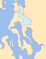
Fir Island is bounded by North and South Forks of the Skagit River and Skagit Bay of Puget Sound in the southwestern corner of Skagit County, Washington. Triangular in outline, 5.3 miles (8.5 km) east–west by 6.5 miles (10.5 km) north–south with an area of nearly 9,900 acres (40 km2), Fir Island is occupied by 195 families. The island is connected by bridge to the village of Conway, located on the east shore of the South Fork of the Skagit River. A second bridge, across the North Fork of the Skagit River, leads to La Conner, 3.7 miles (6.0 km) northwest. Near the northeast tip of Fir Island is the site of the 19th-century town of Skagit City which declined after upstream log jams were removed in 1877.
Excerpt from the Wikipedia article Fir Island (Washington) (License: CC BY-SA 3.0, Authors, Images).Fir Island (Washington)
Dry Slough Road,
Geographical coordinates (GPS) Address Nearby Places Show on map
Geographical coordinates (GPS)
| Latitude | Longitude |
|---|---|
| N 48.35 ° | E -122.38333333333 ° |
Address
Dry Slough Road 20525
98273
Washington, United States
Open on Google Maps


