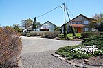
Highway 87 (Golan Heights and Israel)
Infobox road instances in IsraelInfobox road maps tracking categoryRoads in IsraelRoads in Israeli-occupied territories

Highway 87 is a 35 km long east-west highway in northern Israel and the Israeli-occupied Golan Heights. It extends from the northern shores of Lake Kinneret through the central Golan Heights. It begins in the west at Kfar Nahum/Capernaum and ends in the east at Bashan Junction.
Excerpt from the Wikipedia article Highway 87 (Golan Heights and Israel) (License: CC BY-SA 3.0, Authors, Images).Highway 87 (Golan Heights and Israel)
87, Golan Regional Council
Geographical coordinates (GPS) Address Nearby Places Show on map
Geographical coordinates (GPS)
| Latitude | Longitude |
|---|---|
| N 32.919722222222 ° | E 35.675555555556 ° |
Address
87
1294900 Golan Regional Council
North District, Israel
Open on Google Maps


