Reigate and Banstead
Boroughs in EnglandCoast to Capital Local Enterprise PartnershipIncomplete lists from May 2022Non-metropolitan districts of SurreyPages with non-numeric formatnum arguments ... and 2 more
ReigateReigate and Banstead

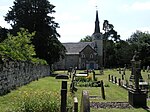
Reigate and Banstead is a local government district with borough status in east Surrey, England. It includes the towns of Reigate, Redhill, Horley and Banstead. The borough borders the Borough of Crawley (in West Sussex) to the south, the Borough of Epsom and Ewell and District of Mole Valley to the west, Tandridge District to the east and the London Boroughs of Sutton and Croydon to the north.
Excerpt from the Wikipedia article Reigate and Banstead (License: CC BY-SA 3.0, Authors, Images).Reigate and Banstead
Frenches Road, Reigate and Banstead
Geographical coordinates (GPS) Address Nearby Places Show on map
Geographical coordinates (GPS)
| Latitude | Longitude |
|---|---|
| N 51.249 ° | E -0.16 ° |
Address
Frenches Road
Frenches Road
RH1 2FR Reigate and Banstead
England, United Kingdom
Open on Google Maps


