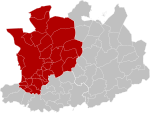
Schoten
Municipalities of Antwerp ProvincePopulated places in Antwerp ProvinceSchoten

Schoten (Dutch pronunciation: [ˈsxoːtə(n)] (listen)) is a municipality located in Antwerp Province, Belgium. The municipality only comprises the town of Schoten proper. As of 1 January 2020 Schoten has a total population of 34,311. The total area is 29.55 km2 (11.41 sq mi) which gives a population density of 1,122/km2 (2,910/sq mi). Schoten borders the Antwerp districts Merksem to the west and Deurne to the south west. Neighboring municipalities include Brasschaat to the north, Brecht to the north east, Schilde to the east, and Wijnegem to the south.
Excerpt from the Wikipedia article Schoten (License: CC BY-SA 3.0, Authors, Images).Schoten
Sint-Cordulaplein,
Geographical coordinates (GPS) Address Nearby Places Show on map
Geographical coordinates (GPS)
| Latitude | Longitude |
|---|---|
| N 51.25 ° | E 4.5 ° |
Address
Braembibliotheek
Sint-Cordulaplein 13
2900
Antwerp, Belgium
Open on Google Maps


