place

Deeping St Nicholas

Civil parishes in LincolnshireSouth Holland, LincolnshireThe DeepingsVillages in LincolnshireWind farms in England
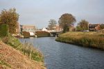
Deeping St.Nicholas church geograph.org.uk 364814

Deeping St Nicholas is a village in Lincolnshire, England, on the A1175 road between The Deepings and Spalding. Unlike Market Deeping, which is in South Kesteven district, Deeping St Nicholas is in South Holland. Deeping St Nicholas is also a South Holland civil parish which includes the small settlements of Tongue End and Hop Pole, and a number of outlying farms. Its population at the 2011 census was 1,961.

Excerpt from the Wikipedia article Deeping St Nicholas (License: CC BY-SA 3.0, Authors, Images).

Deeping St Nicholas
Littleworth Drove, South Holland Deeping St. Nicholas

Geographical coordinates (GPS) Address Nearby Places
placeShow on map

Wikipedia: Deeping St NicholasContinue reading on Wikipedia

Geographical coordinates (GPS)

Latitude Longitude
N 52.7284 ° E -0.20205 °
placeShow on map

Address

Littleworth Drove

Littleworth Drove
PE11 3EN South Holland, Deeping St. Nicholas
England, United Kingdom
mapOpen on Google Maps

Deeping St.Nicholas church geograph.org.uk 364814
Share experience

Nearby Places

Deeping Fen
Deeping Fen

Deeping Fen is a low-lying area in the South Holland district of Lincolnshire, England, which covers approximately 47 square miles (120 km2). It is bounded by the River Welland and the River Glen, and is extensively drained, but the efficient drainage of the land exercised the minds of several of the great civil engineers of the 17th and 18th centuries. Drainage schemes were first authorised during the reign of Queen Elizabeth I, but from 1632, a group of adventurers took control of the drainage, in return for which they were granted land. They faced the problem that the outfalls of the River Welland and the River Glen were not sufficiently low to enable proper drainage by gravity, and most schemes included improvement to the rivers. John Perry, an engineer of some repute, who had set the standard for engineering reports in 1727, began work in 1730, and was followed by John Grundy, Sr., a pioneer in applying scientific principles to civil engineering problems. His son, John Grundy, Jr., was another capable engineer, who was retained as a consultant after he resigned as full-time Surveyor of Works. In 1800 the civil engineers William Jessop and John Rennie assisted local engineers with plans for improvements, the chief of which was for a steam pumping station. This plan was not implemented immediately, but two steam engines fitted with scoop wheels were installed at Pode Hole in 1823. The pumping station was the largest in the Fens at the time, and remained so for many years. Steam gradually gave way to diesel engines and scoop wheels were replaced by centrifugal pumps, and the diesel engines were then replaced by electric motors. However, the beam engine and scoop wheel at Pinchbeck Marsh, which ran from 1833 to 1952, was not scrapped, and can be visited by the public. From 1801 the fen was managed by trustees, appointed under the terms of an act of Parliament obtained in that year, and this remained the case until 1939 when the administrative structure was replaced by the Welland & Deepings Internal Drainage Board.

New River (Fens)
New River (Fens)

The New River is a drainage system in the South Holland district of Lincolnshire, England. Rising just east of Sisson's Farm near Crowland it flows very roughly eastwards, following the general line of the River Welland but a little to the south. It skirts the settlements of Crowland and Cowbit before flowing into the Welland at Cradge Bank near Little London. The land enclosed between the Welland and the New River is referred to as Washland, Crowland Wash and Cowbit Wash being the principal areas. Washland was designed to be sacrificially flooded as a relief of high river levels. The current land usage, and the rights of the drainage authorities to flood it can be traced back at least to an act of parliament of George III, and amended in 1847. The arrangement is not theoretical. Cowbit Wash was flooded annually to protect Spalding until the creation of the Coronation Channel allowed excess water to bypass the town. Even now the option to overspill onto the Wash is available.Although it is customary to say the washes lie between the Welland and the New River, it is more accurate to say that there is an extra bank to the Welland to the south of the New River. It is this bank that restrains the spreading floodwaters: the New River lies in the bottom of this basin to remove the waters. This earthen bank can be seen on the left of the Cloot House photograph above. The availability of a suitable geological feature on which to build this bank determined the shape of the washes, and its location can be traced back through antiquity. To quote Wheeler: The right bank of the Welland between Crowland and Spalding is placed at a distance from the channel of the river varying from a quarter to half a mile leaving an area of about 2500 acres which is covered with water whenever the Welland is in flood. The depth of water in this land in high floods is as much as 5 feet. Originally, no doubt, the land by the side of the Wellland was little better than a Morass, and the banks were placed on the nearest firm ground.