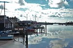
Fingringhoe

Fingringhoe is a village and civil parish in the City of Colchester district of Essex, England. The centre of the village is classified as a conservation area, featuring a traditional village pond and red telephone box. The Roman River flows nearby before entering the River Colne. It has been noted frequently on lists of unusual place names. The village's name actually derives from its geographic circumstances: it sits at the confluence of the smaller Roman River and the River Colne. A "hoe" refers to a jutting out piece of land while "finger" describes an elongated finger-like land extension. "Ing" is a common toponym in the UK referring to "peoples". As such, the name refers to the "people living on the land jutting out into the river".
Excerpt from the Wikipedia article Fingringhoe (License: CC BY-SA 3.0, Authors, Images).Fingringhoe
Church Road, Colchester Fingringhoe
Geographical coordinates (GPS) Address Nearby Places Show on map
Geographical coordinates (GPS)
| Latitude | Longitude |
|---|---|
| N 51.844 ° | E 0.947 ° |
Address
Church Road
CO5 7BL Colchester, Fingringhoe
England, United Kingdom
Open on Google Maps


