Houghton Saint Giles

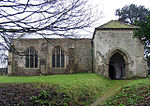
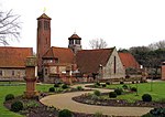
Houghton Saint Giles is a village and former civil parish, now in the parish of Barsham, in the North Norfolk district, in the English county of Norfolk. It has also been referred to as Houghton-le-Dale or Houghton-in-the-Hole. In 1931 the parish had a population of 142.The villages name means 'hill-spur farm/settlement'. The village is one of four settlements that are within the parish of Barsham; the other villages are West Barsham, East Barsham and North Barsham. Originally all four villages had their own parishes, but these were merged to create a single civil parish on 1 April 1935.Houghton Saint Giles is 4.2 miles north of the town of Fakenham, 21.2 miles west of Cromer and 118 miles north of London. The nearest railway station is at Sheringham for the Bittern Line. The nearest airport is Norwich International Airport. A regular bus service is provided as Houghton is on the Coastliner bus route (service number 36) with destinations including Fakenham, Wells-next-the-Sea, Hunstanton and King's Lynn.In the parish is the Basilica of Our Lady of Walsingham, also known as the Slipper Chapel. Built in 1340, it was the last chapel on the pilgrim route to Walsingham.
Excerpt from the Wikipedia article Houghton Saint Giles (License: CC BY-SA 3.0, Authors, Images).Houghton Saint Giles
Pilgrims Way, North Norfolk Barsham
Geographical coordinates (GPS) Address Nearby Places Show on map
Geographical coordinates (GPS)
| Latitude | Longitude |
|---|---|
| N 52.88536 ° | E 0.857714 ° |
Address
Pilgrims Way
Pilgrims Way
NR22 6AQ North Norfolk, Barsham
England, United Kingdom
Open on Google Maps


