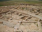
Umm Batin
2004 establishments in IsraelAl-Kasom Regional CouncilArab villages in IsraelBedouin localities in IsraelPopulated places established in 2004 ... and 1 more
Populated places in Southern District (Israel)

Umm Batin (Arabic: أم بطين; Hebrew: אום בטין) is a Bedouin village in southern Israel. Located in the northern Negev desert, 12 km northeast of Beersheba and adjacent to the highway 60, it falls under the jurisdiction of al-Kasom Regional Council. In 2021 it had a population of 4,705.
Excerpt from the Wikipedia article Umm Batin (License: CC BY-SA 3.0, Authors, Images).Umm Batin
al-Qasoum Regional Council
Geographical coordinates (GPS) Address Nearby Places Show on map
Geographical coordinates (GPS)
| Latitude | Longitude |
|---|---|
| N 31.280277777778 ° | E 34.884722222222 ° |
Address
al-Qasoum Regional Council
South District, Israel
Open on Google Maps


