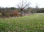
Staplehurst
Borough of MaidstoneCivil parishes in KentEngvarB from July 2016Villages in Kent

Staplehurst is a town and civil parish in the borough of Maidstone in Kent, England, 9 miles (14 km) south of the town of Maidstone and with a population of 6,003. The village lies on the route of a Roman road, which is now incorporated into the course of the A229. The name Staplehurst comes from the Old English 'stapol' meaning a 'post, pillar' and 'hyrst', as a 'wooded hill'; therefore, 'wooded-hill at a post', a possible reference to a boundary marker at the position of All Saints' church atop the hill along the road from Maidstone to Cranbrook. The parish includes the hamlet of Hawkenbury.
Excerpt from the Wikipedia article Staplehurst (License: CC BY-SA 3.0, Authors, Images).Staplehurst
Cornforth Close,
Geographical coordinates (GPS) Address Nearby Places Show on map
Geographical coordinates (GPS)
| Latitude | Longitude |
|---|---|
| N 51.164 ° | E 0.553 ° |
Address
Monument
Cornforth Close 5
TN12 0BP , Staplehurst
England, United Kingdom
Open on Google Maps


