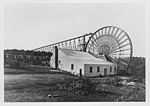
Fryerstown, Victoria
Fryerstown is a town in the Goldfields region of Victoria, Australia. At the 2016 census, Fryerstown and the surrounding area had a population of 228, which peaked at 15,000 during the Victorian gold rush. The Post Office opened on 19 April 1854 as Fryer's Creek, was renamed Fryerstown in 1856, and closed in 1975. Fryerstown Court House opened in 1879 and closed in 1930.Fryerstown formerly had a police station, court, churches, school, hotels and various stores. All are now closed and the nearest general store, church or petrol station is now at Chewton, Campbells Creek or Castlemaine. There is a public hall. Gardenvale Primary School's school camp used to be located in Fryerstown.
Excerpt from the Wikipedia article Fryerstown, Victoria (License: CC BY-SA 3.0, Authors).Fryerstown, Victoria
Vaughan - Chewton Road, Shire of Mount Alexander
Geographical coordinates (GPS) Address Nearby Places Show on map
Geographical coordinates (GPS)
| Latitude | Longitude |
|---|---|
| N -37.133333333333 ° | E 144.25 ° |
Address
Vaughan - Chewton Road
Vaughan - Chewton Road
3451 Shire of Mount Alexander (Chewton)
Victoria, Australia
Open on Google Maps


