place

Twin Mountain (Greene County, New York)

Catskill High PeaksCatskill Mountains, New York geography stubsMountains of Greene County, New York
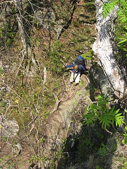
Twin North Summit View

Twin Mountain is a mountain located in Greene County, New York. Twin gets its name from its two summits; the lower, 3,590-ft (1,090 m) peak is about .5 miles (0.8 km) to the southeast of the higher. The mountain is part of the Devil's Path range of the Catskill Mountains. To the northwest, Twin Mtn. is separated from Sugarloaf Mountain by Pecoy Notch; to the southeast, Twin Mtn. is separated from Indian Head Mountain by Jimmy Dolan Notch. Twin Mountain stands within the watershed of the Hudson River, which drains into New York Bay. The northwest end and northeast side of Twin Mtn. drain into the headwaters of Schoharie Creek, thence into the Mohawk River, and the Hudson River. The southeast end of Twin Mtn. drains into Saw Kill, thence into Esopus Creek, and the Hudson River. The southwest side of Twin drains into Beaver Kill, thence into Esopus Creek. Twin Mountain is contained within New York's Catskill State Park. The Devil's Path hiking trail traverses the summit ridge of Twin. The Long Path, a 350-mile (560 km) long-distance hiking trail through southeastern New York, is contiguous with this stretch of the Devil's Path.

Excerpt from the Wikipedia article Twin Mountain (Greene County, New York) (License: CC BY-SA 3.0, Authors, Images).

Twin Mountain (Greene County, New York)

Geographical coordinates (GPS) Address Website Nearby Places
placeShow on map

Wikipedia: Twin Mountain (Greene County, New York)Continue reading on Wikipedia

Geographical coordinates (GPS)

Latitude Longitude
N 42.125666666667 ° E -74.129333333333 °
placeShow on map

Address

Indian Head Wilderness


New York, United States
mapOpen on Google Maps

Website
dec.ny.gov

linkVisit website

Twin North Summit View
Share experience

Nearby Places

Plateau Mountain (New York)

Plateau Mountain is located in the town of Hunter in Greene County, New York, United States. It is part of the Devil's Path range of the Catskill Mountains. Plateau has a two-mile-long (3.2 km) summit ridge above 3,500 feet (1,100 m). The highest point, at least 3,840 feet (1,170 m), is at the southeast end, facing Sugarloaf Mountain to the east across Mink Hollow Notch. It is the 12th-highest peak in the range Devils Tombstone is located west of Plateau Mountain. The northwest end faces Hunter Mountain to the west across 1,400-foot deep (430 m) Stony Clove Notch. Plateau Mountain stands within the watershed of the Hudson River, which drains into New York Bay. It feeds the Hudson by way of Esopus Creek through Stony Clove Creek from its western slopes, and through Beaver Kill from its southeast end. Its southwest slopes drain into Warner Creek, thence into Stony Clove Creek. The northeastern slopes of Plateau drain into Schoharie Creek, thence into the Mohawk River, and the Hudson River. Plateau Mountain is within New York's Catskill State Park. The Devil's Path hiking trail traverses the summit ridge of Plateau. A section of the Long Path, a 350-mile (560 km) long-distance hiking trail through southeastern New York, climbs up the ridge from Silver Hollow Notch to the Devil's Path midway along the ridge. The Long Path then follows the Devil's Path east to the slopes of Indian Head Mountain on the Catskill Escarpment.