Montborget
Canton of Fribourg geography stubsFormer municipalities of the canton of FribourgPages including recorded pronunciationsPages with Franco-Provençal IPAPages with French IPA ... and 1 more
Villages in the canton of Fribourg
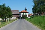
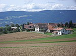
Montborget (French: [mɔ̃bɔʁʒɛ], Franco-Provençal: [mɔ̃bɔʁˈdzɛ] ) is a village and former municipality in the district of Broye in the canton of Fribourg, Switzerland. It was first recorded in 1314 as Mauborget. The municipality had 98 inhabitants in 1811, which increased to 124 in 1850 and 137 in 1900. It then declined to 104 in 1950 and 79 in 1980. In 1981 the municipality was incorporated into the larger, neighboring municipality Murist.
Excerpt from the Wikipedia article Montborget (License: CC BY-SA 3.0, Authors).Montborget
Route des Granges,
Geographical coordinates (GPS) Address Nearby Places Show on map
Geographical coordinates (GPS)
| Latitude | Longitude |
|---|---|
| N 46.800005555556 ° | E 6.7833388888889 ° |
Address
Route des Granges
Route des Granges
1468 (Cheyres)
Vaud, Switzerland
Open on Google Maps


