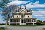
Fort Wetherill
1899 establishments in Rhode Island1948 disestablishments in Rhode IslandAmerican Revolutionary War fortsBritish forts in the United StatesBuildings and structures in Jamestown, Rhode Island ... and 10 more
Buildings and structures in Newport County, Rhode IslandForts in Rhode IslandForts on the National Register of Historic Places in Rhode IslandGovernment buildings completed in 1899Historic American Engineering Record in Rhode IslandNational Register of Historic Places in Newport County, Rhode IslandProtected areas of Newport County, Rhode IslandRuins on the National Register of Historic PlacesUnited States home front during World War IIWar of 1812 forts

Fort Wetherill is a former coast artillery fort that occupies the southern portion of the eastern tip of Conanicut Island in Jamestown, Rhode Island. It sits atop high granite cliffs, overlooking the entrance to Narragansett Bay. Fort Dumpling from the American Revolutionary War occupied the site until it was built over by Fort Wetherill. Wetherill was deactivated and turned over to the State of Rhode Island after World War II and is now operated as Fort Wetherill State Park, a 51-acre (210,000 m2) reservation managed by the Rhode Island Department of Environmental Management.
Excerpt from the Wikipedia article Fort Wetherill (License: CC BY-SA 3.0, Authors, Images).Fort Wetherill
Fort Wetherill Road,
Geographical coordinates (GPS) Address External links Nearby Places Show on map
Geographical coordinates (GPS)
| Latitude | Longitude |
|---|---|
| N 41.477325 ° | E -71.35783 ° |
Address
Battery Varnum
Fort Wetherill Road
02840
Rhode Island, United States
Open on Google Maps


