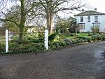
Staple railway station
Disused railway stations in KentFormer East Kent Light Railway stationsPages with no open date in Infobox stationRailway stations in Great Britain closed in 1948Railway stations in Great Britain opened in 1916 ... and 1 more
Use British English from August 2015
Staple railway station was a station on the East Kent Light Railway in southeast England, serving the village of Staple. It was located north of the village, on the west side of the road to Durlock, where it crosses over the Wingham River at Durlock Bridge. The station site is now occupied by a farm.
Excerpt from the Wikipedia article Staple railway station (License: CC BY-SA 3.0, Authors).Staple railway station
Durlock Road,
Geographical coordinates (GPS) Address Nearby Places Show on map
Geographical coordinates (GPS)
| Latitude | Longitude |
|---|---|
| N 51.271944444444 ° | E 1.2597222222222 ° |
Address
Durlock Road
Durlock Road
CT3 1JU
England, United Kingdom
Open on Google Maps


