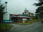
A1081 road
Geographic coordinate listsInfobox road instances in the United KingdomInfobox road maps tracking categoryLists of coordinatesRoads in England ... and 2 more
Roads in HertfordshireUse British English from February 2013

The A1081 is a road in the south of England. It starts at Luton Airport in Bedfordshire and runs to High Barnet in Greater London via Harpenden, St Albans and London Colney, a distance of around 20.5 miles (33.0 km). For most of its length, the A1081 follows the route of the original A6.
Excerpt from the Wikipedia article A1081 road (License: CC BY-SA 3.0, Authors, Images).A1081 road
Harpenden Road, St Albans New Greens
Geographical coordinates (GPS) Address Nearby Places Show on map
Geographical coordinates (GPS)
| Latitude | Longitude |
|---|---|
| N 51.7724 ° | E -0.3354 ° |
Address
Harpenden Road
Harpenden Road
AL3 6DA St Albans, New Greens
England, United Kingdom
Open on Google Maps


