Slaithwaite
Colne ValleyFormer civil parishes in West YorkshireGeography of HuddersfieldTowns in West YorkshireUse British English from November 2013

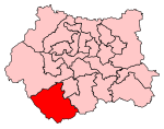
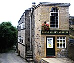
Slaithwaite (, locally 'Slaithwaite' ; Old Norse for "timber-fell thwaite/clearing") is a town and former civil parish in the Colne Valley area of the metropolitan borough of Kirklees, in West Yorkshire, England. Historically part of the West Riding of Yorkshire, it lies in the Colne Valley, lying across the River Colne and the Huddersfield Narrow Canal, approximately 5 miles (8 km) south-west of Huddersfield.
Excerpt from the Wikipedia article Slaithwaite (License: CC BY-SA 3.0, Authors, Images).Slaithwaite
Carr Lane, Kirklees
Geographical coordinates (GPS) Address Nearby Places Show on map
Geographical coordinates (GPS)
| Latitude | Longitude |
|---|---|
| N 53.623 ° | E -1.88 ° |
Address
Cobweb Antiques
Carr Lane 21b
HD7 5AN Kirklees
England, United Kingdom
Open on Google Maps


